|
search place name
|
||
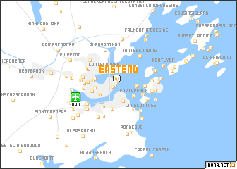
East End (Maine, United States - USA)East End is a town in the Maine region of United States - USA. An overview map of the region around East End is displayed below.
regional and 3d topo map of East End, United States - USA ::
East End airports ::
The nearest airport is PWM - Portland Intl Jetport, located 5.4 km south west of East End.
Other airports nearby include BOS - Boston General Edward Lawrence Logan Intl (157.1 km south west), BED - Bedford Laurence G Hanscom Fld (157.5 km south west), BGR - Bangor Intl (170.2 km north east), YSC - Sherbrooke (228.0 km north west), Nearby towns ::
Munjoy Hill (0.3km north west) //
Portland (0.7km south west) //
East Deering (2.0km north) //
South Portland (2.7km south) //
Fort Gorges (2.1km east) //
Fort Preble (2.5km south east) //
Lunts Corner (2.9km north west) //
West End (2.7km south west) //
Oakdale (2.7km west) //
Woodfords (2.9km west) //
Knightville (3.9km south) //
Woodfords Corner (3.0km west) //
Little Diamond Island Landing (3.0km east) //
Fort Scammel (3.2km south east) //
Pleasantdale (3.9km south west) //
Libbytown (3.2km west) //
Mountainview Park (4.3km south east) //
Highlands (3.5km west) //
Cushing Island (4.2km south east) //
Deering Junction (4.2km north west) //
Great Diamond Island Landing (3.9km east) //
Brighton Corner (3.9km west) //
Jones Wharf (4.0km east) //
Cape Cottage (4.9km south east) //
Bradleys Corner (4.0km west) //
Stanwood Park (5.3km south) //
Morrills Corner (4.4km north west) //
Waites Landing (5.2km north east) //
Deering (4.3km west) //
[all distances 'as the bird flies' and approximate]  Places with similar names to East End, United States - USA ::
Disclaimer :: Information on this page comes without warranty of any kind |
||
|
Where is East End? Elevation and coordinates ::
Latitude (lat): 43°39'54"N Longitude (lon): 70°14'53"W
Elevation (approx.): 42m (map arrows pan, magnifying glasses zoom) |
||
|
Visiting East End? Hotel/Accommodation ::
Book a hotel in East End Travel Guide ::
rental cars ::
car rental offers GPS waypoint ::
download a GPX waypoint (PoI) of East End for your GPS receiver
|
||