|
search place name
|
||
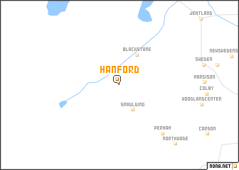
Hanford (Maine, United States - USA)Hanford is a town in the Maine region of United States - USA. An overview map of the region around Hanford is displayed below.
regional and 3d topo map of Hanford, United States - USA ::
Hanford airports ::
The nearest airport is CAR - Caribou Muni, located 19.0 km east of Hanford.
Other airports nearby include PQI - Northern Maine Rgnl At Presque Isle (29.8 km south east), YRI - Riviere Du Loup (137.8 km north west), YFC - Fredericton (176.1 km south east), YCL - Charlo (188.4 km north east), Nearby towns ::
Spaulding (4.2km south) //
Blackstone (5.1km north) //
Perham (9.0km south east) //
[all distances 'as the bird flies' and approximate] 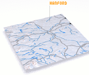 Places with similar names to Hanford, United States - USA ::
Disclaimer :: Information on this page comes without warranty of any kind |
||
|
Where is Hanford? Elevation and coordinates ::
Latitude (lat): 46°54'48"N Longitude (lon): 68°15'34"W
Elevation (approx.): 209m (map arrows pan, magnifying glasses zoom) |
||
|
Visiting Hanford? Hotel/Accommodation ::
Book a hotel in Hanford Travel Guide ::
rental cars ::
car rental offers GPS waypoint ::
download a GPX waypoint (PoI) of Hanford for your GPS receiver
|
||