|
search place name
|
||
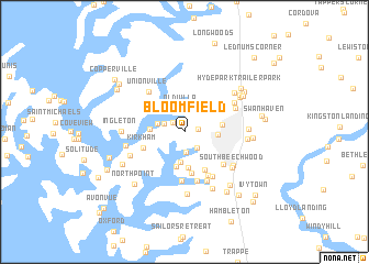
Bloomfield (Maryland, United States - USA)Bloomfield is a town in the Maryland region of United States - USA. An overview map of the region around Bloomfield is displayed below.
regional and 3d topo map of Bloomfield, United States - USA ::
Bloomfield airports ::
The nearest airport is NHK - Patuxent River Nas, located 60.6 km south west of Bloomfield.
Other airports nearby include BWI - Baltimore Washington Intl (65.7 km north west), ADW - Camp Springs Andrews Afb (Washington Dc Naf) (66.1 km west), DOV - Dover Afb (68.0 km north east), SBY - Salisbury Ocean City Wicomico Rgnl (71.1 km south east), Nearby towns ::
North Glenwood (1.1km east) //
North Bend Woodland (1.3km north west) //
Woodland Farms (1.9km south east) //
Waverly (2.0km south) //
North Bend Estates (1.8km north west) //
Glebe Villa (2.3km north) //
Old Villa (2.4km north) //
Doncaster (2.3km west) //
Waverly Island Estates (3.0km south) //
Easton (2.7km east) //
Aveley (2.8km west) //
Peach Orchard (3.6km south) //
Cedar Point (3.7km south) //
Saint Aubins Heights (3.1km east) //
Anchorage (3.4km north west) //
Oaklands (4.2km south) //
Cooks Hope (4.2km south) //
Kirkham (3.6km south west) //
Ellenborough (5.0km south) //
Peachblossom (4.8km south) //
Frankford (4.5km south east) //
Country Club Estates (5.1km south) //
Springfield (5.0km south east) //
Gilnock Hall (5.2km south) //
Unionville (4.9km north west) //
West Galloway (4.7km north east) //
North Easton (4.9km north east) //
Thanksgiving (4.9km south west) //
Beechwood (5.2km south east) //
[all distances 'as the bird flies' and approximate]  Places with similar names to Bloomfield, United States - USA ::
// Bloomfield (US)
// Bloomfield (US)
// Bloomfield (US)
// Bloomfield (US)
// Bloomfield (US)
// Bloomfield (US)
// Bloomfield (US)
// Bloomfield (US)
// Bloomfield (US)
// Bloomfield (US)
Disclaimer :: Information on this page comes without warranty of any kind |
||
|
Where is Bloomfield? Elevation and coordinates ::
Latitude (lat): 38°46'37"N Longitude (lon): 76°6'26"W
Elevation (approx.): 4m (map arrows pan, magnifying glasses zoom) |
||
|
Visiting Bloomfield? Hotel/Accommodation ::
Book a hotel in Bloomfield Travel Guide ::
rental cars ::
car rental offers GPS waypoint ::
download a GPX waypoint (PoI) of Bloomfield for your GPS receiver
|
||