|
search place name
|
||
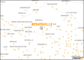
Brownsville (Maryland, United States - USA)Brownsville is a town in the Maryland region of United States - USA. An overview map of the region around Brownsville is displayed below.
regional and 3d topo map of Brownsville, United States - USA ::
Brownsville airports ::
The nearest airport is MDT - Harrisburg Intl, located 68.1 km north east of Brownsville.
Other airports nearby include BWI - Baltimore Washington Intl (73.1 km south east), IAD - Washington Dulles Intl (84.9 km south), APG - Aberdeen Phillips Aaf (92.5 km east), DCA - Ronald Reagan Washington Natl (93.6 km south), Nearby towns ::
Rising Sun (0.9km south) //
Hyser Estates (1.6km north east) //
Ruthed Estates (1.7km east) //
Longville (1.8km east) //
Harney (3.3km north) //
Mairs Mill (3.3km north) //
Bridgeport (2.7km west) //
Longs Mountain View (3.9km south east) //
Walnut Grove (3.4km north east) //
Stonemyer Manor (3.8km north west) //
Taneytown (4.1km south east) //
Bollinger Heights (4.5km north west) //
Mozinger (4.5km west) //
Bullock (4.8km south west) //
Greenland Manor (5.0km east) //
Ottersdale (6.8km south east) //
Crouse Mill (7.5km south) //
Herring Estates (6.7km south east) //
Galt (5.9km east) //
Keysville (7.1km south west) //
Snowden (6.4km south west) //
Dinterman (7.3km south west) //
Copperville (7.3km south east) //
Barlow (8.1km north) //
Stumptown (6.9km south east) //
Eleven Meadows (6.4km east) //
Brown Heights (7.4km south east) //
Carroll View (7.8km south west) //
Woodland Heights (6.7km west) //
[all distances 'as the bird flies' and approximate]  Places with similar names to Brownsville, United States - USA ::
// Barnesville (US)
// Barnesville (US)
// Brownsville (US)
// Burnsville (US)
// Brownsville (US)
// Brownsville (US)
// Brownsville (US)
// Browns Valley (US)
// Brownsville (US)
// Barnesville (US)
Disclaimer :: Information on this page comes without warranty of any kind |
||
|
Where is Brownsville? Elevation and coordinates ::
Latitude (lat): 39°41'4"N Longitude (lon): 77°12'27"W
Elevation (approx.): 151m (map arrows pan, magnifying glasses zoom) |
||
|
Visiting Brownsville? Hotel/Accommodation ::
Book a hotel in Brownsville Travel Guide ::
rental cars ::
car rental offers GPS waypoint ::
download a GPX waypoint (PoI) of Brownsville for your GPS receiver
|
||