|
search place name
|
||
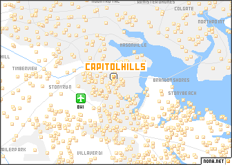
Capitol Hills (Maryland, United States - USA)Capitol Hills is a town in the Maryland region of United States - USA. An overview map of the region around Capitol Hills is displayed below.
regional and 3d topo map of Capitol Hills, United States - USA ::
Capitol Hills airports ::
The nearest airport is BWI - Baltimore Washington Intl, located 5.1 km south west of Capitol Hills.
Other airports nearby include ADW - Camp Springs Andrews Afb (Washington Dc Naf) (48.2 km south west), APG - Aberdeen Phillips Aaf (48.8 km north east), DCA - Ronald Reagan Washington Natl (53.0 km south west), IAD - Washington Dulles Intl (77.9 km west), Nearby towns ::
Woodcrest (0.2km north west) //
Willow (0.3km north) //
Woodcrest Gardens (0.4km south west) //
Harris Heights (0.4km north west) //
Glenmore (0.6km south east) //
Heritage Hill (0.7km west) //
Brooklyn Terrace (0.8km north east) //
Glen Ridge (1.0km south) //
Cromwell Station (0.8km east) //
Cromwell Fountain (1.0km south east) //
Morris Hills (1.0km east) //
Bentwillow Heights (1.2km south west) //
Pleasantville (1.3km south west) //
Arundel Gardens (1.6km north) //
Rippling Ridge (1.6km south) //
Wellington (1.5km south west) //
North Welham (1.7km south west) //
Furnace Branch (1.9km south) //
Lynnbrook (1.8km north west) //
Guilford Manor (2.2km north) //
Nottingham (1.7km west) //
Arundel Hills (1.8km west) //
Sunnyfield Estates (1.9km north west) //
Acresville (2.4km south) //
Harbor Valley Estates (2.5km north) //
Trevor Woods (2.4km south west) //
Cadillac Homes (2.6km south) //
Terrace View Estates (2.5km north west) //
Ferndale Farms (2.3km south west) //
[all distances 'as the bird flies' and approximate] 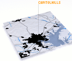 Places with similar names to Capitol Hills, United States - USA :: Disclaimer :: Information on this page comes without warranty of any kind |
||
|
Where is Capitol Hills? Elevation and coordinates ::
Latitude (lat): 39°11'55"N Longitude (lon): 76°37'2"W
Elevation (approx.): 45m (map arrows pan, magnifying glasses zoom) |
||
|
Visiting Capitol Hills? Hotel/Accommodation ::
Book a hotel in Capitol Hills Travel Guide ::
rental cars ::
car rental offers GPS waypoint ::
download a GPX waypoint (PoI) of Capitol Hills for your GPS receiver
|
||