|
search place name
|
||
Ceresville (Maryland, United States - USA)Ceresville is a town in the Maryland region of United States - USA. An overview map of the region around Ceresville is displayed below.
regional and 3d topo map of Ceresville, United States - USA ::

Ceresville airports ::
The nearest airport is IAD - Washington Dulles Intl, located 57.0 km south of Ceresville.
Other airports nearby include BWI - Baltimore Washington Intl (67.7 km south east), DCA - Ronald Reagan Washington Natl (72.6 km south east), ADW - Camp Springs Andrews Afb (Washington Dc Naf) (83.4 km south east), MDT - Harrisburg Intl (97.0 km north east), Nearby towns ::
Discovery (1.4km north) //
Broadview Acres (1.5km west) //
Spring Garden Estates (2.3km north) //
Fountain Rock (2.4km north) //
Tuscarora Knolls (2.1km west) //
Dublin Manor (3.3km north west) //
Harmony Grove (2.8km west) //
Walkersville (3.8km north) //
Stauffer (3.3km north east) //
Mount Pleasant (3.5km east) //
Amber Meadows (3.6km west) //
Pleasant Oaks (3.7km east) //
Green Village (4.9km north) //
Westwood (4.1km south east) //
Arrowhead (4.0km west) //
Rock Chapel Estates (5.3km north) //
Olacin (5.4km south) //
Woodridge (4.8km south east) //
Bartlett Heights (4.3km west) //
Mount Pleasant East (4.4km east) //
Silver Hill (4.5km east) //
Greenbrier (4.9km north east) //
Tulip Hill (5.9km south) //
Spring Ridge (5.9km south) //
Hansonville (5.5km north west) //
Clear View (6.0km south) //
Devon Farms (6.1km north) //
Remsburg Heights (4.7km east) //
Scouts Knoll (4.9km east) //
[all distances 'as the bird flies' and approximate] 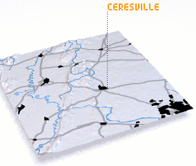 Places with similar names to Ceresville, United States - USA ::
// Searsville (US)
// Searsville (US)
// Sarahsville (US)
// Sirsuphal (IN)
// Sārī Soflá (IR)
// Sīr-e Soflá (IR)
Disclaimer :: Information on this page comes without warranty of any kind |
||
|
Where is Ceresville? Elevation and coordinates ::
Latitude (lat): 39°27'13"N Longitude (lon): 77°22'1"W
Elevation (approx.): 82m (map arrows pan, magnifying glasses zoom) |
||
|
Visiting Ceresville? Hotel/Accommodation ::
Book a hotel in Ceresville Travel Guide ::
rental cars ::
car rental offers GPS waypoint ::
download a GPX waypoint (PoI) of Ceresville for your GPS receiver
|
||