|
search place name
|
||
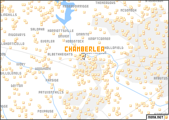
Chamberlea (Maryland, United States - USA)Chamberlea is a town in the Maryland region of United States - USA. An overview map of the region around Chamberlea is displayed below.
regional and 3d topo map of Chamberlea, United States - USA ::
Chamberlea airports ::
The nearest airport is BWI - Baltimore Washington Intl, located 21.0 km south east of Chamberlea.
Other airports nearby include DCA - Ronald Reagan Washington Natl (52.1 km south), ADW - Camp Springs Andrews Afb (Washington Dc Naf) (54.2 km south), APG - Aberdeen Phillips Aaf (61.8 km east), IAD - Washington Dulles Intl (65.3 km south west), Nearby towns ::
North Farm (0.6km north west) //
Bethgate (0.8km south) //
McKenzies Discovery (0.9km north east) //
Bethwood (1.1km south) //
Thornbrook (0.9km east) //
Bethany Manor (1.0km south west) //
Market Square North (1.0km north west) //
Sky View (1.1km south east) //
Maplewood (1.2km north west) //
Market Square South (1.2km west) //
Allenford (1.5km north west) //
Valley Meade (1.8km south) //
Saint Johns Green (1.5km south east) //
The Orchards (1.6km east) //
Southview (1.7km south east) //
Brinkleigh (2.0km south east) //
Waverly Woods (1.8km north west) //
Marydell (1.9km east) //
Oak Lea (2.4km south) //
Turf Valley Overlook (2.2km south west) //
Glen Brook (2.5km south) //
Mount Hebron (2.0km east) //
Pine Orchard (2.5km south) //
Patapsco Park Estates (2.0km east) //
Chatham (2.4km south east) //
Font Hill Manor (2.7km south) //
Chatham Gardens (2.5km south east) //
Brinkleigh Manor (2.3km south east) //
Nob Hill (2.8km south) //
[all distances 'as the bird flies' and approximate] 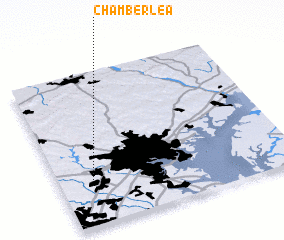 Places with similar names to Chamberlea, United States - USA ::
// Chāmārulla (BD)
// Chāmrul (BD)
// Chimirol (CR)
// Chimirāla (IN)
// Chimriāl (PK)
// Chimriāl (PK)
// Shāi Mehr Ali (PK)
// Shāmurlū (SY)
// Shimbirole (SO)
// Shimbiroole (SO)
Disclaimer :: Information on this page comes without warranty of any kind |
||
|
Where is Chamberlea? Elevation and coordinates ::
Latitude (lat): 39°17'56"N Longitude (lon): 76°51'10"W
Elevation (approx.): 147m (map arrows pan, magnifying glasses zoom) |
||
|
Visiting Chamberlea? Hotel/Accommodation ::
Book a hotel in Chamberlea Travel Guide ::
rental cars ::
car rental offers GPS waypoint ::
download a GPX waypoint (PoI) of Chamberlea for your GPS receiver
|
||