|
search place name
|
||
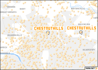
Chestnut Hills (Maryland, United States - USA)Chestnut Hills is a town in the Maryland region of United States - USA. An overview map of the region around Chestnut Hills is displayed below.
regional and 3d topo map of Chestnut Hills, United States - USA ::
Chestnut Hills airports ::
The nearest airport is DCA - Ronald Reagan Washington Natl, located 19.8 km south of Chestnut Hills.
Other airports nearby include ADW - Camp Springs Andrews Afb (Washington Dc Naf) (28.3 km south east), BWI - Baltimore Washington Intl (35.5 km north east), IAD - Washington Dulles Intl (37.8 km west), APG - Aberdeen Phillips Aaf (89.0 km north east), Nearby towns ::
Chestnut Ridge (0.6km north west) //
Northbrook Estates (0.7km west) //
Sligo Woods (0.8km south east) //
Northwood Forest (0.9km north east) //
Glenview (0.9km west) //
Glen Haven (0.9km north west) //
Forest Estates (1.1km south west) //
Sunset Terrace (1.3km south east) //
Sanford (1.4km south west) //
Wheaton Forest (1.5km north west) //
Kemp Mill (1.6km north east) //
Kemp Mill Estates (1.7km north east) //
Northwood Park (1.5km east) //
Carroll Knolls (1.6km south west) //
Plyers Mill Estates (1.6km west) //
Fairway (1.7km south east) //
Stephen Knolls (1.6km west) //
North Hills Sligo Park (2.1km south east) //
McKenney Hills (1.9km south west) //
Woodside Forest (2.4km south) //
Four Corners (2.1km south east) //
Woodmoor (2.0km east) //
Woodside Park (2.6km south) //
Wheaton (2.2km north west) //
Montgomery Hills (2.5km south west) //
Grey Estates (2.5km north east) //
Arcola (2.5km north west) //
Forest Glen (2.5km south west) //
Indian Spring Terrace (2.6km south east) //
[all distances 'as the bird flies' and approximate] 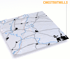 Places with similar names to Chestnut Hills, United States - USA ::
// Chestnut Hills (US)
// Chestnut Hills (US)
// Chestnut Hills (US)
// Chestnut Hills (US)
// Chestnut Hills (US)
Disclaimer :: Information on this page comes without warranty of any kind |
||
|
Where is Chestnut Hills? Elevation and coordinates ::
Latitude (lat): 39°1'48"N Longitude (lon): 77°2'0"W
Elevation (approx.): 117m (map arrows pan, magnifying glasses zoom) |
||
|
Visiting Chestnut Hills? Hotel/Accommodation ::
Book a hotel in Chestnut Hills Travel Guide ::
rental cars ::
car rental offers GPS waypoint ::
download a GPX waypoint (PoI) of Chestnut Hills for your GPS receiver
|
||