|
search place name
|
||
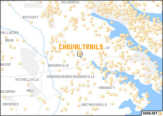
Cheval Trails (Maryland, United States - USA)Cheval Trails is a town in the Maryland region of United States - USA. An overview map of the region around Cheval Trails is displayed below.
regional and 3d topo map of Cheval Trails, United States - USA ::
Cheval Trails airports ::
The nearest airport is BWI - Baltimore Washington Intl, located 21.9 km north of Cheval Trails.
Other airports nearby include ADW - Camp Springs Andrews Afb (Washington Dc Naf) (27.7 km south west), DCA - Ronald Reagan Washington Natl (37.9 km west), APG - Aberdeen Phillips Aaf (67.2 km north east), IAD - Washington Dulles Intl (71.5 km west), Nearby towns ::
Lavall Woods (0.5km south east) //
Lavall (0.6km east) //
Rutland (1.1km south west) //
Huntington Woods (1.6km north) //
Lake of the Pines (1.5km south west) //
Hallmark Woods (1.6km north west) //
Bladen (2.1km north) //
Rutland Estates (2.3km south) //
South River Spring Lakes (2.3km south east) //
Chesterfield (2.5km north) //
Eagles Passages (2.2km south east) //
Gravely (2.6km south) //
Hermitage Hill (2.4km north west) //
Heather Woods (2.6km west) //
Chestnut Ridge (3.0km north west) //
Harbor Hills (3.1km south east) //
Tara (3.6km south) //
Davidsonville Farmettes (3.1km west) //
The Ridges (3.4km east) //
Eickelberry Woods (4.0km south east) //
North River Forest (3.5km east) //
Hidden Cove (3.5km east) //
South River Towers (3.6km east) //
Heritage Harbour (3.6km east) //
Bon Haven (3.7km east) //
Blue Ridge At Crofton Meadows (4.4km north west) //
Twin Hills (3.9km east) //
Sylmac (4.1km north east) //
Farish Farms (4.5km north east) //
[all distances 'as the bird flies' and approximate] 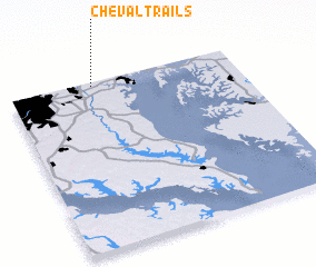 Places with similar names to Cheval Trails, United States - USA :: Disclaimer :: Information on this page comes without warranty of any kind |
||
|
Where is Cheval Trails? Elevation and coordinates ::
Latitude (lat): 38°58'47"N Longitude (lon): 76°37'56"W
Elevation (approx.): 34m (map arrows pan, magnifying glasses zoom) |
||
|
Visiting Cheval Trails? Hotel/Accommodation ::
Book a hotel in Cheval Trails Travel Guide ::
rental cars ::
car rental offers GPS waypoint ::
download a GPX waypoint (PoI) of Cheval Trails for your GPS receiver
|
||