|
search place name
|
||
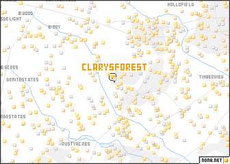
Clarys Forest (Maryland, United States - USA)Clarys Forest is a town in the Maryland region of United States - USA. An overview map of the region around Clarys Forest is displayed below.
regional and 3d topo map of Clarys Forest, United States - USA ::
Clarys Forest airports ::
The nearest airport is BWI - Baltimore Washington Intl, located 19.7 km east of Clarys Forest.
Other airports nearby include DCA - Ronald Reagan Washington Natl (41.9 km south), ADW - Camp Springs Andrews Afb (Washington Dc Naf) (44.6 km south), IAD - Washington Dulles Intl (57.1 km south west), APG - Aberdeen Phillips Aaf (68.4 km north east), Nearby towns ::
Swansfield (0.5km north) //
Cedar Woods (0.5km south east) //
Hawthorn North (0.7km east) //
Cedar Acres (1.0km south) //
Harpers Choice (1.1km north east) //
Hawthorn (1.3km south east) //
Hobbits Glen (1.6km north west) //
Braeburn (1.9km south) //
Faulkner Ridge (1.8km north east) //
Woodleigh (1.9km south east) //
La Isla (2.3km south) //
Clemens Crossing (2.1km south east) //
Longfellow (2.3km north east) //
Beech Creek (2.5km north) //
Elioak (2.6km north) //
Bryant Woods (2.3km north east) //
Gaither Farm Estates (2.9km north) //
Simpsonville (2.9km south) //
Sebring (2.5km south east) //
Point of Homewood (3.1km north) //
Clarksville Meadows (3.0km south west) //
Forest Hills (2.6km west) //
Patuxent Hills (2.8km north west) //
The Birches (3.0km north east) //
Holiday Hills (3.7km south) //
Clarksville Ridge (3.5km south west) //
Chriswood Manor (3.0km west) //
Riverside Estates (4.0km south) //
Allview Estates (3.4km south east) //
[all distances 'as the bird flies' and approximate] 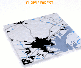 Places with similar names to Clarys Forest, United States - USA :: Disclaimer :: Information on this page comes without warranty of any kind |
||
|
Where is Clarys Forest? Elevation and coordinates ::
Latitude (lat): 39°12'42"N Longitude (lon): 76°53'30"W
Elevation (approx.): 132m (map arrows pan, magnifying glasses zoom) |
||
|
Visiting Clarys Forest? Hotel/Accommodation ::
Book a hotel in Clarys Forest Travel Guide ::
rental cars ::
car rental offers GPS waypoint ::
download a GPX waypoint (PoI) of Clarys Forest for your GPS receiver
|
||