|
search place name
|
||
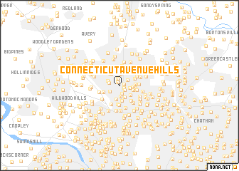
Connecticut Avenue Hills (Maryland, United States - USA)Connecticut Avenue Hills is a town in the Maryland region of United States - USA. An overview map of the region around Connecticut Avenue Hills is displayed below.
regional and 3d topo map of Connecticut Avenue Hills, United States - USA ::
Connecticut Avenue Hills airports ::
The nearest airport is DCA - Ronald Reagan Washington Natl, located 21.9 km south of Connecticut Avenue Hills.
Other airports nearby include ADW - Camp Springs Andrews Afb (Washington Dc Naf) (32.0 km south east), IAD - Washington Dulles Intl (34.5 km west), BWI - Baltimore Washington Intl (38.4 km east), APG - Aberdeen Phillips Aaf (91.4 km north east), Nearby towns ::
Holiday Park (0.5km north west) //
Connecticut Gardens (0.6km east) //
Kensington Knolls (0.7km south east) //
Viers Mill Village (1.0km north) //
Newport Hills (1.0km south east) //
Rock Creek Palisades (1.3km south) //
Connecticut Avenue Estates (1.3km north east) //
College View (1.3km east) //
Ken Gar (1.7km south) //
Randolph Hills (1.4km west) //
Garrett Park (1.5km south west) //
Connecticut Avenue Park (1.8km north) //
Franklin Park (1.6km north west) //
North Kensington (1.9km south) //
Stoney Brook Estates (2.1km north) //
Wheaton Hills (1.7km east) //
Stoney Brook (2.0km north west) //
Kensington Estates (2.2km south) //
Kensington Heights (2.1km south east) //
Kensington View (1.9km south east) //
Kensington (2.4km south) //
Robindale (2.2km north west) //
Monterrey Village (2.0km east) //
Glemont Forest (2.1km north east) //
Wheaton Crest (2.0km east) //
Garrett Park Estates (2.3km south west) //
Wheaton (2.2km east) //
Wheaton Woods (2.8km north) //
Glenmont Hills (2.6km north east) //
[all distances 'as the bird flies' and approximate] 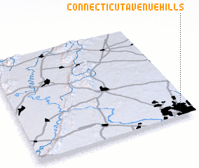 Places with similar names to Connecticut Avenue Hills, United States - USA :: Disclaimer :: Information on this page comes without warranty of any kind |
||
|
Where is Connecticut Avenue Hills? Elevation and coordinates ::
Latitude (lat): 39°2'48"N Longitude (lon): 77°4'48"W
Elevation (approx.): 94m (map arrows pan, magnifying glasses zoom) |
||
|
Visiting Connecticut Avenue Hills? Hotel/Accommodation ::
Book a hotel in Connecticut Avenue Hills Travel Guide ::
rental cars ::
car rental offers GPS waypoint ::
download a GPX waypoint (PoI) of Connecticut Avenue Hills for your GPS receiver
|
||