|
search place name
|
||
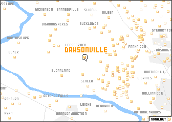
Dawsonville (Maryland, United States - USA)Dawsonville is a town in the Maryland region of United States - USA. An overview map of the region around Dawsonville is displayed below.
regional and 3d topo map of Dawsonville, United States - USA ::
Dawsonville airports ::
The nearest airport is IAD - Washington Dulles Intl, located 22.6 km south west of Dawsonville.
Other airports nearby include DCA - Ronald Reagan Washington Natl (40.5 km south east), ADW - Camp Springs Andrews Afb (Washington Dc Naf) (54.3 km south east), BWI - Baltimore Washington Intl (58.6 km east), APG - Aberdeen Phillips Aaf (108.0 km east), Nearby towns ::
Potomac Park Estate (3.0km south) //
Lees Corner (2.9km north west) //
Blackrock Mill (2.5km east) //
Brookmead (3.8km east) //
Harlow (4.5km south east) //
Blackrock Hills (3.9km north east) //
Pioneer Hills (3.9km south east) //
Brookmead North (3.8km east) //
Browns Corner (4.0km south east) //
Spring Meadows (4.3km south east) //
Blackrock Estates (4.1km east) //
Seneca (5.5km south) //
Brownstown (4.4km east) //
Ridgeland Farm Estates (5.1km south east) //
Woodbyran Farms (5.4km south east) //
Sugarland (5.2km south west) //
Seneca Highlands (5.2km south east) //
Darnestown (5.3km south east) //
Cedar Creek Estates (5.3km north east) //
Brownstown Estates (5.1km east) //
Darnestown Knolls (5.5km south east) //
Rushville (6.6km south) //
Jonesville (5.7km north west) //
Hartley Hall Estates (6.1km south east) //
Kingsview Knolls (5.8km north east) //
Mitchells Range (5.5km east) //
Rive Gauche Estates (6.6km south east) //
Boyds (6.7km north east) //
Deakins Range (6.5km south east) //
[all distances 'as the bird flies' and approximate] 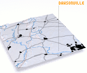 Places with similar names to Dawsonville, United States - USA ::
// Tysonville (US)
// Dawsonville (US)
// Deasonville (US)
// Dawsonville (US)
// Tysonville (US)
// Dawsonville (US)
// Dawsonville (KE)
// Tizi nʼOufella (MA)
// Dossainville (FR)
// Douzonville (FR)
Disclaimer :: Information on this page comes without warranty of any kind |
||
|
Where is Dawsonville? Elevation and coordinates ::
Latitude (lat): 39°7'42"N Longitude (lon): 77°20'36"W
Elevation (approx.): 97m (map arrows pan, magnifying glasses zoom) |
||
|
Visiting Dawsonville? Hotel/Accommodation ::
Book a hotel in Dawsonville Travel Guide ::
rental cars ::
car rental offers GPS waypoint ::
download a GPX waypoint (PoI) of Dawsonville for your GPS receiver
|
||