|
search place name
|
||
Dreams Landing (Maryland, United States - USA)Dreams Landing is a town in the Maryland region of United States - USA. An overview map of the region around Dreams Landing is displayed below.
regional and 3d topo map of Dreams Landing, United States - USA ::

Dreams Landing airports ::
The nearest airport is BWI - Baltimore Washington Intl, located 23.2 km north west of Dreams Landing.
Other airports nearby include ADW - Camp Springs Andrews Afb (Washington Dc Naf) (37.6 km south west), DCA - Ronald Reagan Washington Natl (48.6 km west), APG - Aberdeen Phillips Aaf (59.1 km north east), NHK - Patuxent River Nas (80.4 km south), Nearby towns ::
Lindamoor on the Severn (0.5km south) //
Riverview Manor (0.9km south) //
Luce Creek (0.8km south west) //
Winchester-on-the-Severn (1.1km north) //
Weems Creek (1.0km south west) //
Mariners Cove (1.3km south) //
The Village (1.1km south west) //
Hickory Hills (1.4km north east) //
Bancroft (1.5km north) //
Dellwood (1.4km west) //
Hidden Hills (1.9km north east) //
Wardour (1.7km south east) //
Lincoln Heights (1.7km south west) //
Pines-on-Severn (1.9km north east) //
Pine Bluff (2.1km north) //
West Annapolis (2.0km south east) //
Wardour Bluffs (1.9km south east) //
Winchester (1.9km north east) //
Briar Cliff on the Severn (2.3km north) //
Joyce (2.2km north) //
Ashcroft (2.2km north) //
Severn Grove (1.8km west) //
Epping Forest (1.9km north west) //
Admiral Heights (2.4km south) //
Manresa (1.9km east) //
Epping Farms (2.0km west) //
Indian Hills (2.4km north east) //
Harbour Glen (2.9km north) //
Severnside (2.3km east) //
[all distances 'as the bird flies' and approximate] 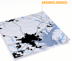 Places with similar names to Dreams Landing, United States - USA :: Disclaimer :: Information on this page comes without warranty of any kind |
||
|
Where is Dreams Landing? Elevation and coordinates ::
Latitude (lat): 39°0'20"N Longitude (lon): 76°30'45"W
Elevation (approx.): 20m (map arrows pan, magnifying glasses zoom) |
||
|
Visiting Dreams Landing? Hotel/Accommodation ::
Book a hotel in Dreams Landing Travel Guide ::
rental cars ::
car rental offers GPS waypoint ::
download a GPX waypoint (PoI) of Dreams Landing for your GPS receiver
|
||