|
search place name
|
||
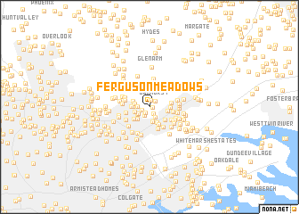
Ferguson Meadows (Maryland, United States - USA)Ferguson Meadows is a town in the Maryland region of United States - USA. An overview map of the region around Ferguson Meadows is displayed below.
regional and 3d topo map of Ferguson Meadows, United States - USA ::
Ferguson Meadows airports ::
The nearest airport is APG - Aberdeen Phillips Aaf, located 29.0 km east of Ferguson Meadows.
Other airports nearby include BWI - Baltimore Washington Intl (29.8 km south west), ADW - Camp Springs Andrews Afb (Washington Dc Naf) (73.7 km south west), DCA - Ronald Reagan Washington Natl (77.5 km south west), ILG - Wilmington New Castle (82.2 km east), Nearby towns ::
Northwind Farms (0.3km east) //
Harmony Hills (0.8km north) //
Northwind Village (0.8km south west) //
Hines Estates (0.9km south east) //
North Wind Farms (0.8km south west) //
Oakhurst (1.0km north east) //
Cloverfield Manor (1.2km south west) //
Spring Hill (1.4km south) //
North Wind (1.2km west) //
Pennbrook (1.3km south west) //
Britinay Hills (1.5km south west) //
Cub Hill (1.4km west) //
Knoll Acres (1.5km west) //
Fullerton Farms (1.9km south) //
Village of Vanderway (1.6km south west) //
Carney Grove (1.9km south west) //
Necker (2.1km south) //
Cub Hills (1.8km north west) //
Harford Farms (1.8km west) //
Cedarside Farm (1.8km east) //
Silver Meadow (2.4km south east) //
Oak Summit (2.2km south west) //
Silver Spring Station (2.2km south east) //
Pinedale (2.0km east) //
Perry View (2.2km east) //
Silver Hill Farm (2.9km south) //
Joppa View (2.3km east) //
Revere Park (2.4km west) //
Silvergate East (2.8km south east) //
[all distances 'as the bird flies' and approximate] 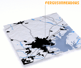 Places with similar names to Ferguson Meadows, United States - USA :: Disclaimer :: Information on this page comes without warranty of any kind |
||
|
Where is Ferguson Meadows? Elevation and coordinates ::
Latitude (lat): 39°24'31"N Longitude (lon): 76°29'50"W
Elevation (approx.): 106m (map arrows pan, magnifying glasses zoom) |
||
|
Visiting Ferguson Meadows? Hotel/Accommodation ::
Book a hotel in Ferguson Meadows Travel Guide ::
rental cars ::
car rental offers GPS waypoint ::
download a GPX waypoint (PoI) of Ferguson Meadows for your GPS receiver
|
||