|
search place name
|
||
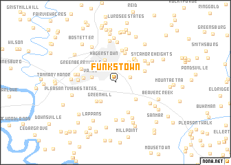
Funkstown (Maryland, United States - USA)Funkstown is a town in the Maryland region of United States - USA. An overview map of the region around Funkstown is displayed below.
regional and 3d topo map of Funkstown, United States - USA ::
Funkstown airports ::
The nearest airport is IAD - Washington Dulles Intl, located 76.8 km south of Funkstown.
Other airports nearby include AOO - Altoona Blair Co (92.7 km north west), BWI - Baltimore Washington Intl (101.4 km south east), DCA - Ronald Reagan Washington Natl (101.9 km south east), MDT - Harrisburg Intl (103.4 km north east), Nearby towns ::
Colonial Park (2.4km north) //
Brightwood Acres (2.0km north east) //
Green Hill (3.6km south west) //
Vardo (3.1km west) //
Sunset Acres (3.8km north east) //
Hagerstown (3.9km north) //
El Rancho Mobile Home Park (3.7km south east) //
Saint James Village (3.9km south west) //
Bridgeport (4.3km north east) //
Trengail Manor (4.4km north east) //
Security (4.8km north) //
Jefferson Heights (4.5km north east) //
Robinwood (4.0km north east) //
Oak Ridge (4.0km west) //
Cool Hollow Estates (5.1km south) //
Potomac Manor (5.3km north) //
Fiddlesburg (5.6km north) //
Green Hill Acres (5.1km north east) //
Greenberry Hills (4.8km north west) //
Roxbury (6.1km south) //
Woodmoor (4.7km west) //
Robinwood (5.1km north east) //
Roxbury Hill (6.1km south) //
Halfway (4.8km west) //
Mountain View Estates (6.1km south) //
Doubs Mill (5.5km south east) //
Terrace Hills (6.6km north) //
Halfway Manor (5.2km west) //
Fountain Head (6.7km north) //
[all distances 'as the bird flies' and approximate]  Places with similar names to Funkstown, United States - USA ::
Disclaimer :: Information on this page comes without warranty of any kind |
||
|
Where is Funkstown? Elevation and coordinates ::
Latitude (lat): 39°36'32"N Longitude (lon): 77°42'17"W
Elevation (approx.): 149m (map arrows pan, magnifying glasses zoom) |
||
|
Visiting Funkstown? Hotel/Accommodation ::
Book a hotel in Funkstown Travel Guide ::
rental cars ::
car rental offers GPS waypoint ::
download a GPX waypoint (PoI) of Funkstown for your GPS receiver
|
||