|
search place name
|
||
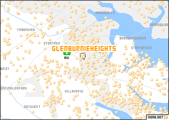
Glen Burnie Heights (Maryland, United States - USA)Glen Burnie Heights is a town in the Maryland region of United States - USA. An overview map of the region around Glen Burnie Heights is displayed below.
regional and 3d topo map of Glen Burnie Heights, United States - USA ::
Glen Burnie Heights airports ::
The nearest airport is BWI - Baltimore Washington Intl, located 3.5 km north west of Glen Burnie Heights.
Other airports nearby include ADW - Camp Springs Andrews Afb (Washington Dc Naf) (43.6 km south west), DCA - Ronald Reagan Washington Natl (48.8 km south west), APG - Aberdeen Phillips Aaf (52.7 km north east), IAD - Washington Dulles Intl (75.0 km west), Nearby towns ::
Saunders (0.4km south east) //
Somerset (0.6km south east) //
Willowdale (0.7km north) //
Brookfield (0.7km west) //
Meadow Brook (0.7km west) //
Monroe Gardens (0.8km south east) //
Glen Burnie (0.9km north east) //
Aquahart Manor (1.0km south east) //
Cohansey Village (1.1km south west) //
Lehigh (1.4km south east) //
Glenbrook (1.4km west) //
Glen Burnie Park (1.8km south) //
Towering Oaks (1.5km east) //
Oak Ridge Manor (1.6km south east) //
Oakwood Manor (1.7km south east) //
Ferndale Manor (2.0km north) //
Dundee (2.0km south) //
Harundale (1.7km east) //
Glen Gardens (1.8km north east) //
Trevor Woods (2.3km north) //
Ferdinand Heights (2.4km north) //
Arbordale (2.1km south east) //
Timberline (2.1km north east) //
Woodside Square (2.3km south west) //
Woods Edge (2.6km south) //
Twin Ridge (2.4km south east) //
Glenwood (2.2km east) //
Cromwell Manor (2.8km north) //
Ferndale (2.8km north) //
[all distances 'as the bird flies' and approximate] 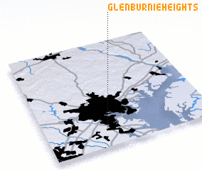 Places with similar names to Glen Burnie Heights, United States - USA :: Disclaimer :: Information on this page comes without warranty of any kind |
||
|
Where is Glen Burnie Heights? Elevation and coordinates ::
Latitude (lat): 39°9'30"N Longitude (lon): 76°38'1"W
Elevation (approx.): 22m (map arrows pan, magnifying glasses zoom) |
||
|
Visiting Glen Burnie Heights? Hotel/Accommodation ::
Book a hotel in Glen Burnie Heights Travel Guide ::
rental cars ::
car rental offers GPS waypoint ::
download a GPX waypoint (PoI) of Glen Burnie Heights for your GPS receiver
|
||