|
search place name
|
||
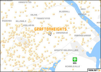
Grafton Heights (Maryland, United States - USA)Grafton Heights is a town in the Maryland region of United States - USA. An overview map of the region around Grafton Heights is displayed below.
regional and 3d topo map of Grafton Heights, United States - USA ::
Grafton Heights airports ::
The nearest airport is APG - Aberdeen Phillips Aaf, located 11.3 km south east of Grafton Heights.
Other airports nearby include BWI - Baltimore Washington Intl (54.6 km south west), ILG - Wilmington New Castle (57.3 km east), DOV - Dover Afb (81.9 km south east), MDT - Harrisburg Intl (84.3 km north west), Nearby towns ::
Friendship Heights (0.7km north) //
Moxley Acres (1.4km north west) //
Woodside (1.3km north east) //
Calvary (1.4km south west) //
Chatham (1.6km south west) //
Bodt Corner (1.4km east) //
Churchville (1.8km north) //
Deerhaven (1.7km north west) //
Corns Manor (2.1km north west) //
Hemlock Ridge (2.6km south) //
Bramblewood (2.4km north west) //
Harford Ranchettes (2.1km west) //
Meadow Springs (2.3km west) //
Campus Valley Estates (2.6km north west) //
Campus Hill Farms (2.9km north west) //
Oakwood (2.4km east) //
Lyns Rest (2.7km south west) //
Priestford Hills (3.4km north) //
Montreal Acres (2.9km south east) //
Rolling Green (3.6km north) //
Shucks Corners (3.0km south west) //
Campus Hills Estates (3.3km north west) //
Sunrise Mobile Home Park (3.3km south west) //
Allendale Estates (4.0km north) //
Carsin Vale (3.6km south east) //
Happy Knoll (3.9km south) //
Stoney Forest Estates (4.1km south) //
Carsinwood (3.5km south east) //
Carsins (3.4km east) //
[all distances 'as the bird flies' and approximate]  Places with similar names to Grafton Heights, United States - USA ::
// Groveton Heights (US)
Disclaimer :: Information on this page comes without warranty of any kind |
||
|
Where is Grafton Heights? Elevation and coordinates ::
Latitude (lat): 39°32'42"N Longitude (lon): 76°15'4"W
Elevation (approx.): 120m (map arrows pan, magnifying glasses zoom) |
||
|
Visiting Grafton Heights? Hotel/Accommodation ::
Book a hotel in Grafton Heights Travel Guide ::
rental cars ::
car rental offers GPS waypoint ::
download a GPX waypoint (PoI) of Grafton Heights for your GPS receiver
|
||