|
search place name
|
||
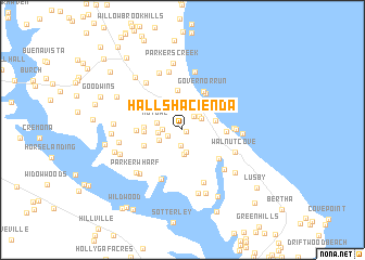
Halls Hacienda (Maryland, United States - USA)Halls Hacienda is a town in the Maryland region of United States - USA. An overview map of the region around Halls Hacienda is displayed below.
regional and 3d topo map of Halls Hacienda, United States - USA ::
Halls Hacienda airports ::
The nearest airport is NHK - Patuxent River Nas, located 22.1 km south east of Halls Hacienda.
Other airports nearby include ADW - Camp Springs Andrews Afb (Washington Dc Naf) (48.7 km north west), DCA - Ronald Reagan Washington Natl (62.1 km north west), BWI - Baltimore Washington Intl (80.0 km north), SBY - Salisbury Ocean City Wicomico Rgnl (89.7 km east), Nearby towns ::
Home Place (0.4km south east) //
Mackall Estates (1.3km south west) //
Wallville Acres (1.6km south) //
Lancaster Hill (1.7km north east) //
Matapeake (1.6km west) //
Maryland Gardens (2.0km north east) //
Saint Leonard (1.9km north east) //
Nostalgia (2.3km south) //
Another Place (2.5km south) //
Forest Glade (2.0km west) //
Chippingwood (2.5km north) //
Ross Woods (2.1km south west) //
Mutual (2.2km west) //
Hillside Manor (3.1km north) //
Western Shores (3.3km north) //
Calvert Beach Park (2.8km east) //
Western Shore Estates (3.4km north east) //
Blue Dolphin Estates (3.1km west) //
Mutual Consent (3.1km west) //
Mutual Estates (3.6km north west) //
Port Republic (4.1km north) //
Island Creek (3.6km south west) //
Kenwood Beach (4.2km north east) //
Calvert Beach Estates (3.6km east) //
Governor Run (4.4km north east) //
Olde Mill (3.7km west) //
Saint Leonard Shores (4.2km south east) //
Calvert Beach (4.1km east) //
Flag Harbor (4.3km east) //
[all distances 'as the bird flies' and approximate] 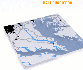 Places with similar names to Halls Hacienda, United States - USA :: Disclaimer :: Information on this page comes without warranty of any kind |
||
|
Where is Halls Hacienda? Elevation and coordinates ::
Latitude (lat): 38°27'50"N Longitude (lon): 76°31'29"W
Elevation (approx.): 35m (map arrows pan, magnifying glasses zoom) |
||
|
Visiting Halls Hacienda? Hotel/Accommodation ::
Book a hotel in Halls Hacienda Travel Guide ::
rental cars ::
car rental offers GPS waypoint ::
download a GPX waypoint (PoI) of Halls Hacienda for your GPS receiver
|
||