|
search place name
|
||
Harvest Farms (Maryland, United States - USA)Harvest Farms is a town in the Maryland region of United States - USA. An overview map of the region around Harvest Farms is displayed below.
regional and 3d topo map of Harvest Farms, United States - USA ::

Harvest Farms airports ::
The nearest airport is BWI - Baltimore Washington Intl, located 32.1 km south east of Harvest Farms.
Other airports nearby include DCA - Ronald Reagan Washington Natl (59.9 km south), ADW - Camp Springs Andrews Afb (Washington Dc Naf) (63.9 km south), APG - Aberdeen Phillips Aaf (65.7 km east), IAD - Washington Dulles Intl (67.0 km south west), Nearby towns ::
Melstone Valley (0.6km south west) //
Hilltop (0.7km west) //
Carroll Highlands (0.7km north east) //
Carrolltowne (0.9km north west) //
Ridgely Park (1.0km north) //
Sweet Air (1.1km north) //
Arrington Estates (1.0km north west) //
Clipper Hill Estates (1.1km south west) //
Brimfield (1.2km west) //
Forest Hill Farms (1.4km south east) //
Freedom Forest (1.6km north) //
Ridgemar (1.5km south east) //
Squires (1.7km north east) //
Amberly (1.6km south west) //
Lake Hills (1.7km south east) //
Eazee Acres (2.0km south west) //
Bonnie Brae (1.9km north west) //
Forest Oaks (2.2km north) //
The Hemlocks (2.3km north) //
Freedom Village (2.4km north west) //
Long Meadows (2.5km north west) //
Liberty Lake Hills (2.8km north east) //
Oklahoma (3.2km north) //
Liberty Manor (3.1km north east) //
Branton Manor (2.7km north east) //
Wright Acres (3.2km north east) //
Shervettes Corner (2.9km north east) //
Eldersburg (3.1km north west) //
Lakeview (3.5km north) //
[all distances 'as the bird flies' and approximate] 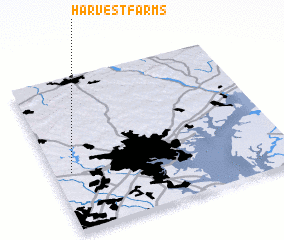 Places with similar names to Harvest Farms, United States - USA :: Disclaimer :: Information on this page comes without warranty of any kind |
||
|
Where is Harvest Farms? Elevation and coordinates ::
Latitude (lat): 39°23'4"N Longitude (lon): 76°55'30"W
Elevation (approx.): 166m (map arrows pan, magnifying glasses zoom) |
||
|
Visiting Harvest Farms? Hotel/Accommodation ::
Book a hotel in Harvest Farms Travel Guide ::
rental cars ::
car rental offers GPS waypoint ::
download a GPX waypoint (PoI) of Harvest Farms for your GPS receiver
|
||