|
search place name
|
||
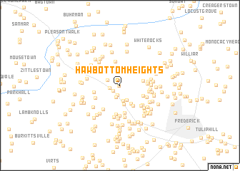
Hawbottom Heights (Maryland, United States - USA)Hawbottom Heights is a town in the Maryland region of United States - USA. An overview map of the region around Hawbottom Heights is displayed below.
regional and 3d topo map of Hawbottom Heights, United States - USA ::
Hawbottom Heights airports ::
The nearest airport is IAD - Washington Dulles Intl, located 59.0 km south of Hawbottom Heights.
Other airports nearby include BWI - Baltimore Washington Intl (79.6 km south east), DCA - Ronald Reagan Washington Natl (80.1 km south east), ADW - Camp Springs Andrews Afb (Washington Dc Naf) (92.1 km south east), MDT - Harrisburg Intl (102.1 km north east), Nearby towns ::
Hawbottom (0.1km south west) //
Gambrill South (1.2km south west) //
Hollow Road Estates (1.5km south) //
Hollow Estates (1.3km west) //
Valley View Estates (1.9km south) //
Cross Hollow (1.7km north west) //
Phelps (2.4km south) //
Catoctin Acres (2.5km south) //
Arch Bridge (3.0km south) //
Hilltop Woods (3.1km south east) //
Harmony (2.9km north west) //
Mountain Laurel Estates (2.9km east) //
Irongate (3.5km south east) //
Fishers Hollow (3.7km north) //
Edgewood (3.2km south east) //
Westchester (3.3km west) //
Harmony Knolls (3.7km north west) //
Wooded Acres (3.3km east) //
Round Hill (4.3km south) //
Catoctin Hills (3.6km south west) //
Parkview Estates (3.5km east) //
Fountain Dale (4.5km south) //
Deer Ridge (3.7km south east) //
Akers Acres (4.1km south east) //
Foxfield Middletown (4.3km south west) //
Bootjack Springs Estates (3.7km east) //
Edgewood View (4.1km south east) //
Edinburg Forest (4.8km south) //
Eyler Springs (3.7km east) //
[all distances 'as the bird flies' and approximate] 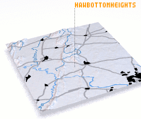 Places with similar names to Hawbottom Heights, United States - USA :: Disclaimer :: Information on this page comes without warranty of any kind |
||
|
Where is Hawbottom Heights? Elevation and coordinates ::
Latitude (lat): 39°28'27"N Longitude (lon): 77°30'25"W
Elevation (approx.): 251m (map arrows pan, magnifying glasses zoom) |
||
|
Visiting Hawbottom Heights? Hotel/Accommodation ::
Book a hotel in Hawbottom Heights Travel Guide ::
rental cars ::
car rental offers GPS waypoint ::
download a GPX waypoint (PoI) of Hawbottom Heights for your GPS receiver
|
||