|
search place name
|
||
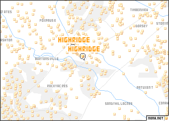
High Ridge (Maryland, United States - USA)High Ridge is a town in the Maryland region of United States - USA. An overview map of the region around High Ridge is displayed below.
regional and 3d topo map of High Ridge, United States - USA ::
High Ridge airports ::
The nearest airport is BWI - Baltimore Washington Intl, located 17.7 km east of High Ridge.
Other airports nearby include DCA - Ronald Reagan Washington Natl (33.3 km south west), ADW - Camp Springs Andrews Afb (Washington Dc Naf) (34.1 km south), IAD - Washington Dulles Intl (55.2 km west), APG - Aberdeen Phillips Aaf (71.0 km north east), Nearby towns ::
Settlers Landing (0.6km south east) //
Hammonds Promise (1.4km north east) //
Canterbury Riding (1.3km north east) //
Cardinal Forest (1.4km north west) //
North Laurel Park (1.4km east) //
Lakeview (1.9km north west) //
Laurel (2.3km south east) //
Lillys Addition (2.1km north west) //
Stonewood (2.1km south west) //
Robinsons Promise (2.3km north east) //
North Ridge (2.0km east) //
Rosemont (2.4km north west) //
North Laurel (2.5km north west) //
Northgate Woods (2.1km east) //
Tower Acres (2.4km north west) //
Midway Mobile Home Park (2.4km south east) //
Beech Crest Mobile Estates (2.3km east) //
High Ridge (2.7km north west) //
Chelsea Estates (2.6km north west) //
Carriage Hill (2.6km south west) //
Rocky Gorge Estates (2.5km west) //
Evemar Mobile Home Park (2.7km north east) //
Saybrook (3.0km north west) //
Pfister Mobile Home Park (2.6km east) //
Scotchtown Hills (2.9km south west) //
Walker Hill (2.9km south west) //
Mistletoe Springs (3.6km south) //
Murray Hill (3.4km north west) //
Oak Crest (3.6km south) //
[all distances 'as the bird flies' and approximate]  Places with similar names to High Ridge, United States - USA ::
// High Ridge (US)
// High Ridge (US)
// High Ridge (US)
// High Ridge (US)
// High Ridge (US)
// Highridge (KE)
// Highridge (CA)
// High Ridge (US)
// High Ridge (US)
Disclaimer :: Information on this page comes without warranty of any kind |
||
|
Where is High Ridge? Elevation and coordinates ::
Latitude (lat): 39°7'5"N Longitude (lon): 76°51'32"W
Elevation (approx.): 80m (map arrows pan, magnifying glasses zoom) |
||
|
Visiting High Ridge? Hotel/Accommodation ::
Book a hotel in High Ridge Travel Guide ::
rental cars ::
car rental offers GPS waypoint ::
download a GPX waypoint (PoI) of High Ridge for your GPS receiver
|
||