|
search place name
|
||
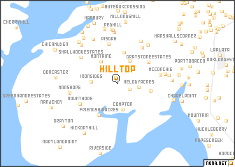
Hill Top (Maryland, United States - USA)Hill Top is a town in the Maryland region of United States - USA. An overview map of the region around Hill Top is displayed below.
regional and 3d topo map of Hill Top, United States - USA ::
Hill Top airports ::
The nearest airport is DCA - Ronald Reagan Washington Natl, located 41.0 km north of Hill Top.
Other airports nearby include ADW - Camp Springs Andrews Afb (Washington Dc Naf) (42.1 km north east), IAD - Washington Dulles Intl (58.3 km north west), NHK - Patuxent River Nas (66.0 km east), BWI - Baltimore Washington Intl (85.8 km north east), Nearby towns ::
Welcome Acres (1.8km south east) //
Melody Acres (2.7km east) //
Garden Estates (3.9km north) //
Ironsides (3.3km west) //
Compton (4.3km south) //
Montaine (4.1km north west) //
Mount Pisgah (5.0km north) //
Cedar Grove (4.3km east) //
Friendship Acres (5.6km south west) //
Graystone Estates (5.2km north east) //
Pisgah (6.5km north) //
Mount Hope (5.7km south west) //
Nelson (6.5km north east) //
McConchie (5.6km east) //
Smallwood Estates (6.2km north west) //
Myrtle Grove Estates (7.4km north east) //
Marshope (6.2km west) //
Port Tobacco Hills (6.2km east) //
Ripley (7.3km north east) //
Charleston Gardens (7.7km north west) //
Jones View (8.2km north) //
Ellerslie Heights (6.6km east) //
Rison Acres (7.7km north west) //
Redhill (8.6km north) //
Redhill Estates (8.7km north) //
Penn Manor (6.9km east) //
Holly Haven (8.9km north) //
Pleasant Grove Estates (8.4km north west) //
Rison (8.2km north west) //
[all distances 'as the bird flies' and approximate] 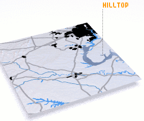 Places with similar names to Hill Top, United States - USA ::
Disclaimer :: Information on this page comes without warranty of any kind |
||
|
Where is Hill Top? Elevation and coordinates ::
Latitude (lat): 38°29'20"N Longitude (lon): 77°7'20"W
Elevation (approx.): 41m (map arrows pan, magnifying glasses zoom) |
||
|
Visiting Hill Top? Hotel/Accommodation ::
Book a hotel in Hill Top Travel Guide ::
rental cars ::
car rental offers GPS waypoint ::
download a GPX waypoint (PoI) of Hill Top for your GPS receiver
|
||