|
search place name
|
||
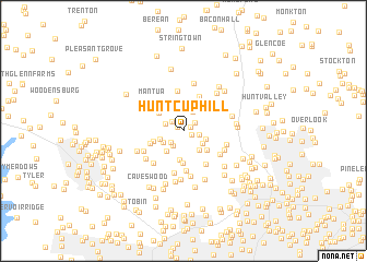
Hunt Cup Hill (Maryland, United States - USA)Hunt Cup Hill is a town in the Maryland region of United States - USA. An overview map of the region around Hunt Cup Hill is displayed below.
regional and 3d topo map of Hunt Cup Hill, United States - USA ::
Hunt Cup Hill airports ::
The nearest airport is BWI - Baltimore Washington Intl, located 33.9 km south of Hunt Cup Hill.
Other airports nearby include APG - Aberdeen Phillips Aaf (47.2 km east), DCA - Ronald Reagan Washington Natl (74.8 km south), ADW - Camp Springs Andrews Afb (Washington Dc Naf) (75.2 km south), MDT - Harrisburg Intl (79.5 km north), Nearby towns ::
Briarwood Farms (0.6km north west) //
Shawan Valley (0.6km north east) //
Fox Ridge Estates (0.8km south east) //
Jonathans Delight (1.2km north east) //
Tufton Ridge Estates (1.3km north west) //
Springhill Farms (1.3km east) //
Knollcrest Manor (1.6km south west) //
Autumn Wind (1.7km south west) //
Tufton Farms (1.6km north west) //
Shawan (2.1km north) //
The Pines at Deep Run (2.0km south east) //
Worthington Club Estates (2.0km south west) //
Broadmeade (2.0km south east) //
Morrisville (2.3km south east) //
Worthington Ridge (2.0km south west) //
Chestnut Ridge (2.5km south west) //
Green Valley North (2.9km south) //
Hickory Meadow (2.7km south east) //
Big Spring (2.7km north west) //
Waterspout (2.6km south west) //
Sugarvale Estates (3.3km south) //
Worthington Greens (3.0km south west) //
Gentsville (3.7km north) //
Oregon (3.4km north east) //
Ridgemont (3.8km south east) //
Pine Hill Farms (4.1km north) //
Cronhardt (4.1km south) //
Mantua (3.8km north west) //
Caves Park (4.3km south) //
[all distances 'as the bird flies' and approximate]  Places with similar names to Hunt Cup Hill, United States - USA :: Disclaimer :: Information on this page comes without warranty of any kind |
||
|
Where is Hunt Cup Hill? Elevation and coordinates ::
Latitude (lat): 39°28'42"N Longitude (lon): 76°43'2"W
Elevation (approx.): 203m (map arrows pan, magnifying glasses zoom) |
||
|
Visiting Hunt Cup Hill? Hotel/Accommodation ::
Book a hotel in Hunt Cup Hill Travel Guide ::
rental cars ::
car rental offers GPS waypoint ::
download a GPX waypoint (PoI) of Hunt Cup Hill for your GPS receiver
|
||