|
search place name
|
||
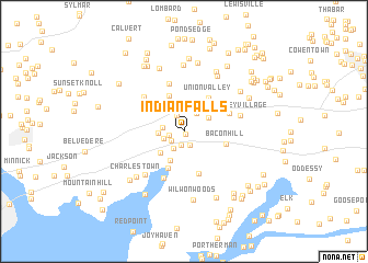
Indian Falls (Maryland, United States - USA)Indian Falls is a town in the Maryland region of United States - USA. An overview map of the region around Indian Falls is displayed below.
regional and 3d topo map of Indian Falls, United States - USA ::
Indian Falls airports ::
The nearest airport is APG - Aberdeen Phillips Aaf, located 26.3 km south west of Indian Falls.
Other airports nearby include ILG - Wilmington New Castle (28.8 km east), PHL - Philadelphia Intl (65.7 km north east), DOV - Dover Afb (67.3 km south east), MIV - Millville Muni (78.9 km east), Nearby towns ::
Prestige Village (0.3km south) //
Altamont Place (1.4km south) //
Timberbrook (1.2km west) //
Cool Springs Park (1.5km south) //
Cedar Hill (1.3km south west) //
Lum Estates (1.7km north) //
North East (1.9km south west) //
North East Park (1.8km south west) //
Leslie (1.7km west) //
Mechanic Valley (2.1km north east) //
Lakeside Park South (2.1km west) //
Eder (2.4km north east) //
North East Isles (2.9km south west) //
North East Harbor (3.2km south) //
Stony Chase Court (3.8km north) //
De La Plaine Manor (3.9km south) //
Union Valley (3.9km north east) //
Bay View (4.0km north west) //
Bacon Hill (3.6km east) //
La Plaine Estates (4.5km south) //
Forest Green Court (4.0km north east) //
Beulah Land (5.0km north) //
Northeast Heights (5.0km south) //
Westminister (4.7km north west) //
Charlestown Manor Beach (5.4km south west) //
Marley Village (4.7km east) //
Pawnee Lake Hills (6.2km north east) //
Edgewood Hills (6.7km north) //
Charlestown (6.0km south west) //
[all distances 'as the bird flies' and approximate]  Places with similar names to Indian Falls, United States - USA ::
// Indian Falls (US)
// Indian Falls (US)
Disclaimer :: Information on this page comes without warranty of any kind |
||
|
Where is Indian Falls? Elevation and coordinates ::
Latitude (lat): 39°36'56"N Longitude (lon): 75°55'55"W
Elevation (approx.): 27m (map arrows pan, magnifying glasses zoom) |
||
|
Visiting Indian Falls? Hotel/Accommodation ::
Book a hotel in Indian Falls Travel Guide ::
rental cars ::
car rental offers GPS waypoint ::
download a GPX waypoint (PoI) of Indian Falls for your GPS receiver
|
||