|
search place name
|
||
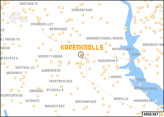
Karen Knolls (Maryland, United States - USA)Karen Knolls is a town in the Maryland region of United States - USA. An overview map of the region around Karen Knolls is displayed below.
regional and 3d topo map of Karen Knolls, United States - USA ::
Karen Knolls airports ::
The nearest airport is ADW - Camp Springs Andrews Afb (Washington Dc Naf), located 34.3 km north of Karen Knolls.
Other airports nearby include NHK - Patuxent River Nas (40.5 km south east), DCA - Ronald Reagan Washington Natl (44.2 km north west), BWI - Baltimore Washington Intl (74.4 km north), IAD - Washington Dulles Intl (76.2 km north west), Nearby towns ::
Walnut Hills (0.5km north east) //
Oakland Acres (1.0km south) //
North Indian Creek Estates (0.9km east) //
Oaks (1.3km south) //
Oak Estates (1.2km south west) //
Hughesville Manor (1.4km north) //
Breezy Knolls (1.3km south east) //
Arborview (1.5km south) //
Pine Grove Estates (1.4km north east) //
Plainview Gardens (1.5km south west) //
Melody Acres (2.0km south) //
Hughesville (2.5km north) //
Knolland (2.2km east) //
Chickasaw Run (2.7km south east) //
Independence Village (2.4km west) //
Charlotte Hall (3.3km south) //
Carrico Mill Estates (2.7km south west) //
Newmarket (4.1km south) //
Patuxent (4.0km north east) //
Patuxent Woods (3.9km north east) //
Belle Ridge Farms (3.9km west) //
Bryantown Estates (4.6km north west) //
Rolling Acres (4.3km south east) //
Cameron Ridge (4.2km west) //
Willerle Manor (4.3km west) //
Woodridge Acres (5.4km north) //
Loves (4.5km east) //
Ridgeview (4.8km north west) //
Holly Acres (5.1km south east) //
[all distances 'as the bird flies' and approximate] 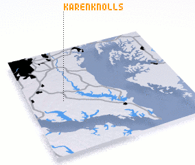 Places with similar names to Karen Knolls, United States - USA ::
// Green Knolls (US)
Disclaimer :: Information on this page comes without warranty of any kind |
||
|
Where is Karen Knolls? Elevation and coordinates ::
Latitude (lat): 38°30'37"N Longitude (lon): 76°46'37"W
Elevation (approx.): 64m (map arrows pan, magnifying glasses zoom) |
||
|
Visiting Karen Knolls? Hotel/Accommodation ::
Book a hotel in Karen Knolls Travel Guide ::
rental cars ::
car rental offers GPS waypoint ::
download a GPX waypoint (PoI) of Karen Knolls for your GPS receiver
|
||