|
search place name
|
||
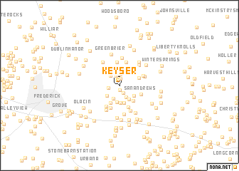
Keyser (Maryland, United States - USA)Keyser is a town in the Maryland region of United States - USA. An overview map of the region around Keyser is displayed below.
regional and 3d topo map of Keyser, United States - USA ::
Keyser airports ::
The nearest airport is IAD - Washington Dulles Intl, located 56.1 km south of Keyser.
Other airports nearby include BWI - Baltimore Washington Intl (62.5 km south east), DCA - Ronald Reagan Washington Natl (69.1 km south), ADW - Camp Springs Andrews Afb (Washington Dc Naf) (79.4 km south east), MDT - Harrisburg Intl (96.2 km north east), Nearby towns ::
McKaig (0.6km south) //
View More Heights (1.1km north) //
Meadows (1.2km south) //
Mount Pleasant East (1.6km north) //
Pleasant Heights (1.8km north) //
Westwood (1.4km west) //
Remsburg Heights (1.8km north) //
Pleasant Estates (2.0km north) //
Balmoral (2.0km south east) //
Pleasant Oaks (1.9km north west) //
Silver Hill (2.2km north) //
Aspen (2.2km south) //
Ten Oaks (2.3km north) //
Hickory Hill (2.4km north) //
Mount Pleasant (2.3km north west) //
Mount Pleasant Estates (2.6km north) //
Pinehurst (2.4km south east) //
North Shore (2.6km south) //
Woodridge (2.2km south west) //
Coldstream (2.7km south) //
Islands of Balmoral (2.3km south east) //
Nightingale (2.7km south) //
Alpine (2.9km south west) //
Lake Anita Louise (2.9km south east) //
Horse Shoe Farms Estates (2.6km north east) //
Sanandrews (2.9km south east) //
Longview (3.5km south) //
Oak Acres (3.6km south) //
Scouts Knoll (3.7km north) //
[all distances 'as the bird flies' and approximate] 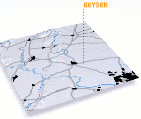 Places with similar names to Keyser, United States - USA ::
Disclaimer :: Information on this page comes without warranty of any kind |
||
|
Where is Keyser? Elevation and coordinates ::
Latitude (lat): 39°26'13"N Longitude (lon): 77°18'37"W
Elevation (approx.): 165m (map arrows pan, magnifying glasses zoom) |
||
|
Visiting Keyser? Hotel/Accommodation ::
Book a hotel in Keyser Travel Guide ::
rental cars ::
car rental offers GPS waypoint ::
download a GPX waypoint (PoI) of Keyser for your GPS receiver
|
||