|
search place name
|
||
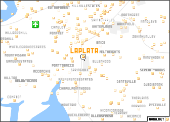
La Plata (Maryland, United States - USA)La Plata is a town in the Maryland region of United States - USA. An overview map of the region around La Plata is displayed below.
regional and 3d topo map of La Plata, United States - USA ::
La Plata airports ::
The nearest airport is ADW - Camp Springs Andrews Afb (Washington Dc Naf), located 32.7 km north of La Plata.
Other airports nearby include DCA - Ronald Reagan Washington Natl (36.3 km north), NHK - Patuxent River Nas (56.2 km south east), IAD - Washington Dulles Intl (62.2 km north west), BWI - Baltimore Washington Intl (76.5 km north), Nearby towns ::
Oakland Estates (1.7km south east) //
Morgans Ridge (2.1km west) //
Radcliffe Estates (2.7km south) //
Valley View (2.3km west) //
Springhill (2.9km south) //
Wood Haven Park (2.7km south east) //
Spring Oak Estates (3.3km south) //
Mariellen Park (3.1km south east) //
Rosewick (3.8km north) //
Ellenwood (3.1km east) //
Hawthorne (3.4km west) //
Jennie Run Estates (4.2km north) //
Highland Estates (3.8km south west) //
Mount Carmel (3.9km north west) //
Warrlinda (4.3km north) //
Lyons Corner (4.4km north) //
Hawthorne Manor (3.5km west) //
Mount Carmel Woods (4.2km north west) //
Roosevelt Heights (3.6km east) //
Forest Grove (4.7km north) //
Brice (4.3km north east) //
Mount Carmel Estates (4.5km north west) //
Newtown (4.3km south east) //
Turkey Hill (5.0km north) //
Port Tobacco (4.1km south west) //
Preference Estates (5.0km south) //
Newtown Estates (4.6km south east) //
Hillwood (5.6km north) //
Rolling Hills (5.7km south) //
[all distances 'as the bird flies' and approximate]  Places with similar names to La Plata, United States - USA ::
Disclaimer :: Information on this page comes without warranty of any kind |
||
|
Where is La Plata? Elevation and coordinates ::
Latitude (lat): 38°31'45"N Longitude (lon): 76°58'32"W
Elevation (approx.): 56m (map arrows pan, magnifying glasses zoom) |
||
|
Visiting La Plata? Hotel/Accommodation ::
Book a hotel in La Plata Travel Guide ::
rental cars ::
car rental offers GPS waypoint ::
download a GPX waypoint (PoI) of La Plata for your GPS receiver
|
||