|
search place name
|
||
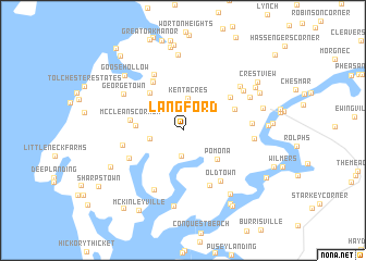
Langford (Maryland, United States - USA)Langford is a town in the Maryland region of United States - USA. An overview map of the region around Langford is displayed below.
regional and 3d topo map of Langford, United States - USA ::
Langford airports ::
The nearest airport is APG - Aberdeen Phillips Aaf, located 30.9 km north of Langford.
Other airports nearby include BWI - Baltimore Washington Intl (45.6 km west), DOV - Dover Afb (58.7 km east), ILG - Wilmington New Castle (71.3 km north east), ADW - Camp Springs Andrews Afb (Washington Dc Naf) (75.6 km south west), Nearby towns ::
Becks Landing (2.6km south) //
Kent Acres (3.0km north) //
Kent Acres (3.3km north) //
Remington Farms (2.7km west) //
Langford Acres (3.5km north east) //
Pomona (4.0km south east) //
Sandy Bottom (3.8km west) //
Fairlee (4.7km north west) //
McCleans Corner (4.3km west) //
Fannells Meadow (4.7km north east) //
Woods Edge (5.5km north west) //
Woods Edge (5.6km north west) //
Orchard Hill (5.1km north east) //
Shipyard Landing (5.2km south west) //
Johnsontown (6.0km south) //
Baywood Manor (6.2km north) //
Reeses Corner (5.1km west) //
Old Town (6.0km south east) //
Langford Bay Estates (6.5km south) //
Heather Heights (5.5km east) //
Georgetown (6.0km north west) //
Piney Grove (5.7km east) //
Coventry Farms (6.4km north east) //
Washington Park (6.2km north east) //
Calvert Heights (6.3km north east) //
Melitota (7.8km north) //
Cliffs City (7.8km south) //
Quaker Neck Landing (7.5km south east) //
Goose Hollow (7.3km north west) //
[all distances 'as the bird flies' and approximate]  Places with similar names to Langford, United States - USA ::
Disclaimer :: Information on this page comes without warranty of any kind |
||
|
Where is Langford? Elevation and coordinates ::
Latitude (lat): 39°11'18"N Longitude (lon): 76°8'28"W
Elevation (approx.): 19m (map arrows pan, magnifying glasses zoom) |
||
|
Visiting Langford? Hotel/Accommodation ::
Book a hotel in Langford Travel Guide ::
rental cars ::
car rental offers GPS waypoint ::
download a GPX waypoint (PoI) of Langford for your GPS receiver
|
||