|
search place name
|
||
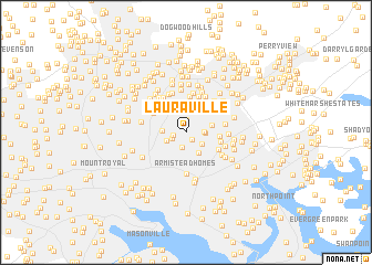
Lauraville (Maryland, United States - USA)Lauraville is a town in the Maryland region of United States - USA. An overview map of the region around Lauraville is displayed below.
regional and 3d topo map of Lauraville, United States - USA ::
Lauraville airports ::
The nearest airport is BWI - Baltimore Washington Intl, located 21.1 km south west of Lauraville.
Other airports nearby include APG - Aberdeen Phillips Aaf (36.1 km east), ADW - Camp Springs Andrews Afb (Washington Dc Naf) (65.0 km south west), DCA - Ronald Reagan Washington Natl (68.7 km south west), IAD - Washington Dulles Intl (89.4 km south west), Nearby towns ::
Anthonyville (0.9km south east) //
Montebello Park (1.0km west) //
Hamilton (1.3km north) //
Beverly Hills (1.3km south west) //
Gardenville (1.6km south) //
Belmar (1.5km east) //
Bellview (1.6km east) //
Cedonia (1.7km south east) //
Hall Spring (1.8km south west) //
Morgan Park (1.9km west) //
Goodnow Hill (2.3km south east) //
Belgravia (2.1km east) //
Woodhome Heights (3.0km north) //
Van Dyke Manor (2.6km east) //
Harford Park (3.6km north) //
Holland Hills (2.9km east) //
Garden Village Park (3.1km south east) //
Ramblewood (3.2km north west) //
Villa Cresta (3.8km north) //
Elmwood (3.1km east) //
Parkville Heights (4.0km north) //
Parkville (3.9km north east) //
Hillendale (4.1km north) //
Lutz Hill (3.3km south east) //
Parkside Heights (3.9km north west) //
Armistead Homes (4.2km south) //
Ashlar Hill (4.1km north) //
Rollins View Green (3.9km north east) //
Bluegrass Heights (3.6km south east) //
[all distances 'as the bird flies' and approximate]  Places with similar names to Lauraville, United States - USA ::
// Luraville (US)
// Lohrville (US)
// Leirfall (NO)
// La Revilla (ES)
// La Revilla (ES)
// La Revilla (ES)
// La Revilla (ES)
// Loreauville (US)
// Loarville (US)
// Larryville (US)
Disclaimer :: Information on this page comes without warranty of any kind |
||
|
Where is Lauraville? Elevation and coordinates ::
Latitude (lat): 39°20'41"N Longitude (lon): 76°33'28"W
Elevation (approx.): 71m (map arrows pan, magnifying glasses zoom) |
||
|
Visiting Lauraville? Hotel/Accommodation ::
Book a hotel in Lauraville Travel Guide ::
rental cars ::
car rental offers GPS waypoint ::
download a GPX waypoint (PoI) of Lauraville for your GPS receiver
|
||