|
search place name
|
||
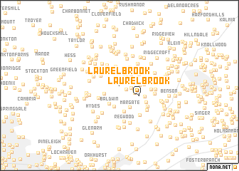
Laurel Brook (Maryland, United States - USA)Laurel Brook is a town in the Maryland region of United States - USA. An overview map of the region around Laurel Brook is displayed below.
regional and 3d topo map of Laurel Brook, United States - USA ::
Laurel Brook airports ::
The nearest airport is APG - Aberdeen Phillips Aaf, located 25.5 km east of Laurel Brook.
Other airports nearby include BWI - Baltimore Washington Intl (42.5 km south west), ILG - Wilmington New Castle (75.1 km east), MDT - Harrisburg Intl (79.2 km north), ADW - Camp Springs Andrews Afb (Washington Dc Naf) (86.4 km south west), Nearby towns ::
Bellvale (0.4km north) //
Charles Manor (0.9km north) //
Fallsmont (1.1km south east) //
Lancaster Corner (1.5km north east) //
Scarff (1.6km north east) //
Tall Oak Manor (1.5km east) //
Round Acres (1.9km north) //
Brandywine Farms (1.6km east) //
Gunpowder Farms (1.9km east) //
Harvest Hills (2.3km north east) //
Baldwin Mill Terrace (2.2km south west) //
Parkshire (2.3km south east) //
Perry Hall Estates (2.9km north) //
Willows (2.6km north east) //
Cloverdale (2.4km east) //
Upper Crossroads (2.8km north west) //
Pleasantville (3.0km north east) //
Green Road Manor (2.9km north west) //
Strathmore (2.5km east) //
Baldwin (3.1km south) //
Orchard Lakes (2.7km north west) //
Long Green Woods (3.4km south) //
Hunting Ridge (2.9km north west) //
Laurel Brook (2.9km south east) //
Woodfield (3.1km north east) //
Oakmont (2.9km north east) //
Cross Country Estates (3.5km north west) //
Long Green Manor (3.2km south west) //
Rochelle Meadows (3.0km east) //
[all distances 'as the bird flies' and approximate] 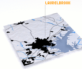 Places with similar names to Laurel Brook, United States - USA ::
Disclaimer :: Information on this page comes without warranty of any kind |
||
|
Where is Laurel Brook? Elevation and coordinates ::
Latitude (lat): 39°31'15"N Longitude (lon): 76°27'25"W
Elevation (approx.): 138m (map arrows pan, magnifying glasses zoom) |
||
|
Visiting Laurel Brook? Hotel/Accommodation ::
Book a hotel in Laurel Brook Travel Guide ::
rental cars ::
car rental offers GPS waypoint ::
download a GPX waypoint (PoI) of Laurel Brook for your GPS receiver
|
||