|
search place name
|
||
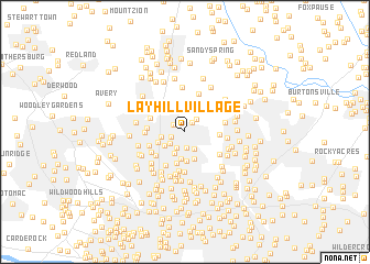
Layhill Village (Maryland, United States - USA)Layhill Village is a town in the Maryland region of United States - USA. An overview map of the region around Layhill Village is displayed below.
regional and 3d topo map of Layhill Village, United States - USA ::
Layhill Village airports ::
The nearest airport is DCA - Ronald Reagan Washington Natl, located 25.8 km south of Layhill Village.
Other airports nearby include ADW - Camp Springs Andrews Afb (Washington Dc Naf) (34.3 km south east), BWI - Baltimore Washington Intl (34.7 km east), IAD - Washington Dulles Intl (38.3 km south west), APG - Aberdeen Phillips Aaf (87.2 km north east), Nearby towns ::
Homecrest (0.8km north west) //
Layhill (1.1km north east) //
Bel Pre Farms (1.2km north west) //
Hermitage Park (1.2km south west) //
Lutes (1.6km south) //
Willson Hills (1.5km north east) //
Foxhall (1.7km south) //
Georgian Forest (1.7km south west) //
Layhill South (1.9km south east) //
Glenmont Hills (2.3km south) //
Aspen Hill (1.9km west) //
Green Wood Knolls (2.1km south west) //
Glenmont Village (2.7km south) //
Glenallen (2.9km south) //
Glenmont (2.9km south) //
Gayfields (2.8km north east) //
Harmony Hills (2.4km south west) //
Rossmoor (2.8km north west) //
Glemont Forest (3.2km south) //
Allanwood (3.2km north east) //
Drumeldra Hills (2.7km east) //
Manor Park (3.1km north west) //
Connecticut Avenue Park (3.3km south west) //
Connecticut Avenue Estates (3.7km south west) //
English Manor (3.0km west) //
Wheaton Woods (3.2km south west) //
Norbeck (3.6km north west) //
Stoney Brook Estates (3.4km south west) //
Wheaton Crest (4.0km south) //
[all distances 'as the bird flies' and approximate] 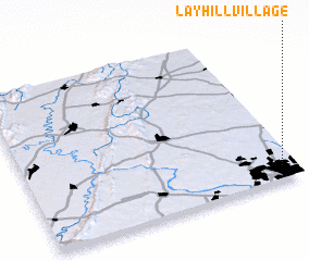 Places with similar names to Layhill Village, United States - USA :: Disclaimer :: Information on this page comes without warranty of any kind |
||
|
Where is Layhill Village? Elevation and coordinates ::
Latitude (lat): 39°5'3"N Longitude (lon): 77°3'6"W
Elevation (approx.): 106m (map arrows pan, magnifying glasses zoom) |
||
|
Visiting Layhill Village? Hotel/Accommodation ::
Book a hotel in Layhill Village Travel Guide ::
rental cars ::
car rental offers GPS waypoint ::
download a GPX waypoint (PoI) of Layhill Village for your GPS receiver
|
||