|
search place name
|
||
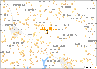
Lees Mill (Maryland, United States - USA)Lees Mill is a town in the Maryland region of United States - USA. An overview map of the region around Lees Mill is displayed below.
regional and 3d topo map of Lees Mill, United States - USA ::
Lees Mill airports ::
The nearest airport is BWI - Baltimore Washington Intl, located 45.4 km south east of Lees Mill.
Other airports nearby include APG - Aberdeen Phillips Aaf (61.2 km east), MDT - Harrisburg Intl (71.7 km north), DCA - Ronald Reagan Washington Natl (79.1 km south), ADW - Camp Springs Andrews Afb (Washington Dc Naf) (82.4 km south), Nearby towns ::
Wesley Chapel (0.7km west) //
Kingston Riding (0.8km south east) //
Southwood (1.3km east) //
Tabbys Delight (1.7km north west) //
Blue Grass Manor (1.8km north east) //
Houcksville (2.1km north) //
Harper Estates (2.2km south west) //
Adams Chance (2.7km north) //
Patapsco (2.4km south west) //
Evergreen Hills (2.8km south west) //
Clydesdale Acres (3.4km south) //
Lawndale (3.5km south) //
Brentwood Acres (2.8km west) //
Southglenn Farms (3.6km south) //
Patapsco Woods (3.4km south west) //
Alma Meadows (3.8km north) //
Wolf Hill (3.4km north east) //
Dominos Acres (3.0km west) //
Fowblesburg (3.1km east) //
Lynwood (3.5km north west) //
Dell Mont (3.1km west) //
Hoffmans Mill (3.7km north west) //
Castle Oaks (4.1km north) //
Upperco (3.3km east) //
Laura Lee Estates (3.4km south west) //
Aspen Run (3.8km north west) //
Fenwood Heights (4.3km south) //
Lismarelu Farms (4.1km north) //
Castles Rising (3.9km south west) //
[all distances 'as the bird flies' and approximate]  Places with similar names to Lees Mill, United States - USA ::
// Lees Mill (US)
// La Semilla (CU)
// Luzmela (ES)
// Lees Mill (US)
// Lees Mill (US)
// Lesmil (US)
// Lees Mill (US)
// Lees Mill (US)
// Lees Mill (US)
// La Asamblea (CO)
Disclaimer :: Information on this page comes without warranty of any kind |
||
|
Where is Lees Mill? Elevation and coordinates ::
Latitude (lat): 39°33'11"N Longitude (lon): 76°52'17"W
Elevation (approx.): 184m (map arrows pan, magnifying glasses zoom) |
||
|
Visiting Lees Mill? Hotel/Accommodation ::
Book a hotel in Lees Mill Travel Guide ::
rental cars ::
car rental offers GPS waypoint ::
download a GPX waypoint (PoI) of Lees Mill for your GPS receiver
|
||