|
search place name
|
||
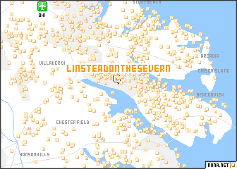
Linstead-on-the-Severn (Maryland, United States - USA)Linstead-on-the-Severn is a town in the Maryland region of United States - USA. An overview map of the region around Linstead-on-the-Severn is displayed below.
regional and 3d topo map of Linstead-on-the-Severn, United States - USA ::
Linstead-on-the-Severn airports ::
The nearest airport is BWI - Baltimore Washington Intl, located 15.4 km north west of Linstead-on-the-Severn.
Other airports nearby include ADW - Camp Springs Andrews Afb (Washington Dc Naf) (38.7 km south west), DCA - Ronald Reagan Washington Natl (47.6 km south west), APG - Aberdeen Phillips Aaf (56.0 km north east), IAD - Washington Dulles Intl (78.7 km west), Nearby towns ::
Point Somerset (0.5km north east) //
Evergreen Estates (0.7km north) //
West Severna Park (1.0km north) //
Old Severna Park (0.9km north east) //
Severna Gardens (1.2km north) //
Colchester on the Severn (1.3km north west) //
Herald Harbor (1.4km south west) //
Severna Forest (1.6km north) //
Robinson (1.7km north) //
Severna Park (1.5km north east) //
Cool Pond (1.8km north) //
Round Bay View (1.5km east) //
Rivendell (1.7km north west) //
Captains Cove (1.9km north) //
Arden on the Severn (1.6km west) //
Bluff Point (1.8km north west) //
Duffield (2.0km north west) //
Holly Point (1.9km north west) //
Severndale (2.2km north west) //
Pack Town (2.4km north) //
Trinity Farms (2.0km north east) //
Maceys Corner (2.2km north east) //
Oakhill (2.4km north) //
Round Bay (2.0km east) //
McKinsey Park (2.2km north east) //
Bendale (2.4km north west) //
Berrywood West (2.7km north) //
Jennings (2.9km north) //
Carrollton Manor (2.4km north west) //
[all distances 'as the bird flies' and approximate] 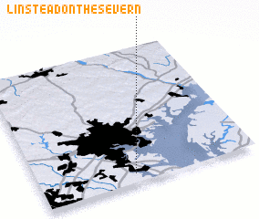 Places with similar names to Linstead-on-the-Severn, United States - USA :: Disclaimer :: Information on this page comes without warranty of any kind |
||
|
Where is Linstead-on-the-Severn? Elevation and coordinates ::
Latitude (lat): 39°3'53"N Longitude (lon): 76°33'39"W
Elevation (approx.): 9m (map arrows pan, magnifying glasses zoom) |
||
|
Visiting Linstead-on-the-Severn? Hotel/Accommodation ::
Book a hotel in Linstead-on-the-Severn Travel Guide ::
rental cars ::
car rental offers GPS waypoint ::
download a GPX waypoint (PoI) of Linstead-on-the-Severn for your GPS receiver
|
||