|
search place name
|
||
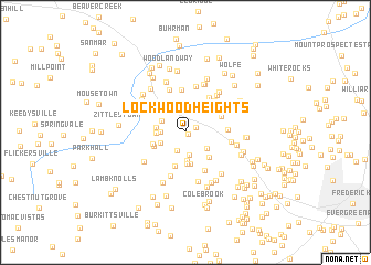
Lockwood Heights (Maryland, United States - USA)Lockwood Heights is a town in the Maryland region of United States - USA. An overview map of the region around Lockwood Heights is displayed below.
regional and 3d topo map of Lockwood Heights, United States - USA ::
Lockwood Heights airports ::
The nearest airport is IAD - Washington Dulles Intl, located 60.0 km south of Lockwood Heights.
Other airports nearby include DCA - Ronald Reagan Washington Natl (83.1 km south east), BWI - Baltimore Washington Intl (84.2 km south east), ADW - Camp Springs Andrews Afb (Washington Dc Naf) (95.5 km south east), MDT - Harrisburg Intl (104.8 km north east), Nearby towns ::
Wiles Estates (0.3km south east) //
Bidle Hill Acres (1.0km north east) //
Middletown View (2.0km south) //
Middletown Heights (2.3km south) //
Station Roads (1.9km west) //
Harshman Estates (2.5km north east) //
Summers (2.2km north west) //
Westchester (2.3km south east) //
Bolivar Heights (2.3km south west) //
Cowell (2.9km south) //
Myersville (3.0km north) //
Oak Park (2.3km west) //
Frostown (2.3km west) //
Spoolsville (3.2km south) //
Highfields (3.0km north east) //
Brookridge North (3.2km south) //
Catoctin Hills (3.1km south east) //
Moser (2.8km south west) //
Bolivar (2.8km south west) //
West Middletown Estates (3.5km south) //
Harmony Knolls (3.2km north east) //
Harmony (3.2km north east) //
Bittle (4.0km north east) //
Vista Farms (3.9km north east) //
Cross Hollow (3.4km east) //
Church Hill Estates (4.3km north) //
Lynch Estates (3.8km north west) //
Middletown (4.2km south) //
Countryside West (4.5km south) //
[all distances 'as the bird flies' and approximate] 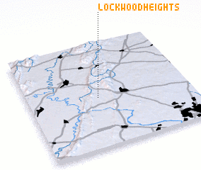 Places with similar names to Lockwood Heights, United States - USA ::
// Lakewood Heights (US)
// Lakewood Heights (US)
// Lockwood Heights (US)
// Lakewood Heights (US)
// Lakewood Heights (US)
Disclaimer :: Information on this page comes without warranty of any kind |
||
|
Where is Lockwood Heights? Elevation and coordinates ::
Latitude (lat): 39°28'43"N Longitude (lon): 77°33'47"W
Elevation (approx.): 186m (map arrows pan, magnifying glasses zoom) |
||
|
Visiting Lockwood Heights? Hotel/Accommodation ::
Book a hotel in Lockwood Heights Travel Guide ::
rental cars ::
car rental offers GPS waypoint ::
download a GPX waypoint (PoI) of Lockwood Heights for your GPS receiver
|
||