|
search place name
|
||
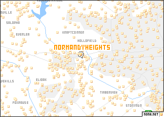
Normandy Heights (Maryland, United States - USA)Normandy Heights is a town in the Maryland region of United States - USA. An overview map of the region around Normandy Heights is displayed below.
regional and 3d topo map of Normandy Heights, United States - USA ::
Normandy Heights airports ::
The nearest airport is BWI - Baltimore Washington Intl, located 17.3 km south east of Normandy Heights.
Other airports nearby include DCA - Ronald Reagan Washington Natl (52.5 km south), ADW - Camp Springs Andrews Afb (Washington Dc Naf) (53.3 km south), APG - Aberdeen Phillips Aaf (58.3 km east), IAD - Washington Dulles Intl (68.0 km south west), Nearby towns ::
Normandy Woods (0.7km south) //
Ivy Hill (0.6km north east) //
Chestnut Hill Estates (0.7km north east) //
Chestnut Farms (1.0km north) //
Oak West (1.0km south) //
Town And Country West (0.9km west) //
The Oaks (0.9km east) //
Sylvan Hill (1.0km east) //
Linwood (1.3km south) //
Rockland (1.3km north west) //
Chestnut Hill (1.2km east) //
River Mills (1.7km south west) //
Chapelview (1.8km south) //
Hilltop (1.8km south) //
Rolling Ridge (1.9km north) //
Ellicott Hills (2.0km south) //
Wilton Farm Acres (1.8km north west) //
Braebrooke (2.1km south) //
Ellicott City (2.5km south) //
Toll House (2.6km south) //
Oella (2.3km south east) //
Brinkleigh Manor (2.1km west) //
Howard Heights (2.2km west) //
Patapsco Park Estates (2.4km north west) //
Chalfone Manor (2.4km south east) //
Timber Point (2.6km south east) //
Marydell (2.4km west) //
Saint Johns Manor (2.8km south west) //
Hollofield (3.1km north) //
[all distances 'as the bird flies' and approximate]  Places with similar names to Normandy Heights, United States - USA :: Disclaimer :: Information on this page comes without warranty of any kind |
||
|
Where is Normandy Heights? Elevation and coordinates ::
Latitude (lat): 39°17'20"N Longitude (lon): 76°48'20"W
Elevation (approx.): 146m (map arrows pan, magnifying glasses zoom) |
||
|
Visiting Normandy Heights? Hotel/Accommodation ::
Book a hotel in Normandy Heights Travel Guide ::
rental cars ::
car rental offers GPS waypoint ::
download a GPX waypoint (PoI) of Normandy Heights for your GPS receiver
|
||