|
search place name
|
||
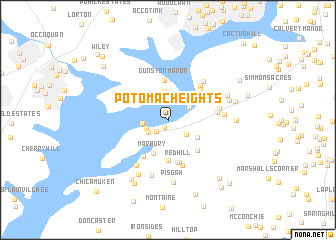
Potomac Heights (Maryland, United States - USA)Potomac Heights is a town in the Maryland region of United States - USA. An overview map of the region around Potomac Heights is displayed below.
regional and 3d topo map of Potomac Heights, United States - USA ::
Potomac Heights airports ::
The nearest airport is DCA - Ronald Reagan Washington Natl, located 28.5 km north of Potomac Heights.
Other airports nearby include ADW - Camp Springs Andrews Afb (Washington Dc Naf) (32.7 km north east), IAD - Washington Dulles Intl (46.3 km north west), NHK - Patuxent River Nas (73.0 km south east), BWI - Baltimore Washington Intl (75.1 km north east), Nearby towns ::
Glymont (0.9km south) //
Perry Wright (1.7km south west) //
Warington Hills (2.2km south west) //
Indian Head (2.1km south west) //
Knotts Crossing (2.3km south east) //
Chapman Landing (2.3km north east) //
Riverview Village (2.2km west) //
Hallowing Point Estates (3.2km north) //
Buteaux Crossing (3.2km south east) //
Marbury (3.9km south) //
Gunston Manor (4.4km north) //
Holly Haven (4.6km south) //
Millards Mill (4.3km south east) //
Redhill Estates (4.8km south) //
Du-Mar Estates (4.6km south west) //
McGhiesport (4.3km north east) //
Redhill (4.8km south) //
Fenwick (4.7km north east) //
Jones View (5.2km south) //
Pomonkey Landing (4.7km north east) //
Montrose (4.4km east) //
Fenwick Shores (5.3km north east) //
Green Meadows (4.7km east) //
Mattawoman Village (5.8km south west) //
Laurel Acres (5.0km east) //
Charleston Gardens (6.4km south) //
Pleasant Grove Estates (6.6km south west) //
Pisgah (7.0km south) //
North Indian Head Estates (5.9km north east) //
[all distances 'as the bird flies' and approximate] 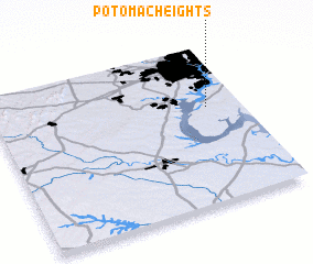 Places with similar names to Potomac Heights, United States - USA ::
// Potomac Heights (US)
Disclaimer :: Information on this page comes without warranty of any kind |
||
|
Where is Potomac Heights? Elevation and coordinates ::
Latitude (lat): 38°36'31"N Longitude (lon): 77°8'27"W
Elevation (approx.): 27m (map arrows pan, magnifying glasses zoom) |
||
|
Visiting Potomac Heights? Hotel/Accommodation ::
Book a hotel in Potomac Heights Travel Guide ::
rental cars ::
car rental offers GPS waypoint ::
download a GPX waypoint (PoI) of Potomac Heights for your GPS receiver
|
||