|
search place name
|
||
Rolling Knolls (Maryland, United States - USA)Rolling Knolls is a town in the Maryland region of United States - USA. An overview map of the region around Rolling Knolls is displayed below.
regional and 3d topo map of Rolling Knolls, United States - USA ::

Rolling Knolls airports ::
The nearest airport is BWI - Baltimore Washington Intl, located 22.0 km north west of Rolling Knolls.
Other airports nearby include ADW - Camp Springs Andrews Afb (Washington Dc Naf) (33.5 km south west), DCA - Ronald Reagan Washington Natl (44.3 km west), APG - Aberdeen Phillips Aaf (62.3 km north east), IAD - Washington Dulles Intl (77.7 km west), Nearby towns ::
Rolling Hills (0.8km north) //
Woytych (0.9km north east) //
Epping Forest Manor (1.1km north east) //
Woodlore (1.0km north east) //
Carriage Hills (1.3km north) //
Marabrooke (1.5km north east) //
Bestgate (1.4km east) //
Oak Court (1.6km south east) //
Threemile Oak Corner (1.6km south east) //
Iglehart (1.8km north) //
The Courtyards (1.7km south east) //
Saltworks on the Severn (1.7km north east) //
The Woods (2.1km north) //
The Downs (2.4km north) //
West Woods (2.3km south east) //
Saefern (2.3km north east) //
Greenwood Acres (2.1km south west) //
Bestgate Terrace (2.1km east) //
Lusby Crossroads (2.2km south west) //
Honeysuckle Ridge (2.5km north west) //
Whiskey Bottom (2.7km south) //
Dunstable Green (2.7km north) //
Kalmia Ridge (2.8km north) //
Sylmac (2.4km west) //
Gingerville Woods (3.0km south) //
Twin Hills (2.4km west) //
Loretta Heights (2.6km south east) //
Gingerville Manor Estates (3.2km south) //
Belvoir Farms (3.0km north west) //
[all distances 'as the bird flies' and approximate] 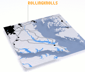 Places with similar names to Rolling Knolls, United States - USA ::
Disclaimer :: Information on this page comes without warranty of any kind |
||
|
Where is Rolling Knolls? Elevation and coordinates ::
Latitude (lat): 38°59'45"N Longitude (lon): 76°33'42"W
Elevation (approx.): 38m (map arrows pan, magnifying glasses zoom) |
||
|
Visiting Rolling Knolls? Hotel/Accommodation ::
Book a hotel in Rolling Knolls Travel Guide ::
rental cars ::
car rental offers GPS waypoint ::
download a GPX waypoint (PoI) of Rolling Knolls for your GPS receiver
|
||