|
search place name
|
||
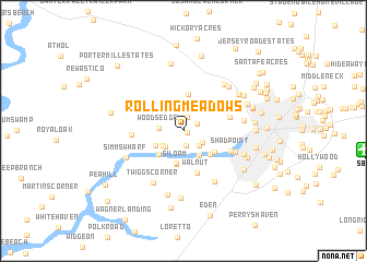
Rolling Meadows (Maryland, United States - USA)Rolling Meadows is a town in the Maryland region of United States - USA. An overview map of the region around Rolling Meadows is displayed below.
regional and 3d topo map of Rolling Meadows, United States - USA ::
Rolling Meadows airports ::
The nearest airport is SBY - Salisbury Ocean City Wicomico Rgnl, located 14.6 km east of Rolling Meadows.
Other airports nearby include NHK - Patuxent River Nas (64.8 km west), DOV - Dover Afb (87.6 km north), WWD - Wildwood Cape May Co (98.4 km north east), ADW - Camp Springs Andrews Afb (Washington Dc Naf) (115.3 km north west), Nearby towns ::
Stonehedge Estates (0.3km east) //
Rockawalking Estates (0.7km north) //
Centennial Village (1.5km north) //
Nithsdale (1.5km south) //
Westbury Acres (1.3km north east) //
Crooked Oak (2.1km north) //
Patricks Landing (1.9km south east) //
River Isle Estates (1.9km south east) //
Rockawalking Acres (2.3km north) //
Woods Edge (2.0km west) //
Upper Ferry Estates (2.2km south west) //
Cedarcrest (2.2km south west) //
Sandy Point (2.9km south east) //
High Bank Estates (2.7km south west) //
Whayland (3.3km south) //
Upper Ferry Acres (3.1km south west) //
Siloam (3.4km south) //
Silver Run (3.2km south east) //
Rockawalking Village (3.8km north) //
Chinaberry Manor (3.3km south east) //
Walnut (4.5km south) //
Ray Park Heights (4.0km east) //
Shad Point (4.3km south east) //
Catchpenny (4.2km west) //
Timberlake (4.7km south east) //
Crows Nest (5.7km south east) //
Twiggs Corner (5.9km south west) //
Pecan Acres (4.9km east) //
Cedarhurst Acres (5.8km north east) //
[all distances 'as the bird flies' and approximate] 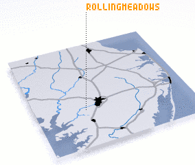 Places with similar names to Rolling Meadows, United States - USA ::
// Rolling Meadows (US)
// Rolling Meadows (US)
// Rolling Meadows (US)
// Rolling Meadows (US)
// Rolling Meadows (US)
// Rolling Meadows (US)
// Rolling Meadows (US)
// Rolling Meadows (US)
// Rolling Meadows (US)
Disclaimer :: Information on this page comes without warranty of any kind |
||
|
Where is Rolling Meadows? Elevation and coordinates ::
Latitude (lat): 38°21'29"N Longitude (lon): 75°40'35"W
Elevation (approx.): 4m (map arrows pan, magnifying glasses zoom) |
||
|
Visiting Rolling Meadows? Hotel/Accommodation ::
Book a hotel in Rolling Meadows Travel Guide ::
rental cars ::
car rental offers GPS waypoint ::
download a GPX waypoint (PoI) of Rolling Meadows for your GPS receiver
|
||