|
search place name
|
||
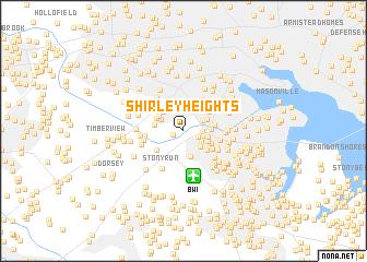
Shirley Heights (Maryland, United States - USA)Shirley Heights is a town in the Maryland region of United States - USA. An overview map of the region around Shirley Heights is displayed below.
regional and 3d topo map of Shirley Heights, United States - USA ::
Shirley Heights airports ::
The nearest airport is BWI - Baltimore Washington Intl, located 4.7 km south of Shirley Heights.
Other airports nearby include ADW - Camp Springs Andrews Afb (Washington Dc Naf) (47.9 km south), DCA - Ronald Reagan Washington Natl (51.1 km south west), APG - Aberdeen Phillips Aaf (51.9 km north east), IAD - Washington Dulles Intl (73.7 km south west), Nearby towns ::
Patapsco (0.9km west) //
Michaelton Manor (1.4km south east) //
Crestwood (1.5km east) //
Kingston Heights (1.8km south east) //
Oak Park (2.2km north) //
Gapgalleon (1.8km east) //
Raynor Heights (1.9km north east) //
Linthicum Heights (2.0km south east) //
Shipley Heights (2.1km south east) //
Halethorpe (2.6km north) //
Hilton Place (2.1km north west) //
Twin Oaks (2.1km east) //
Sweetser Heights (2.2km north east) //
Homeland Park (2.7km south) //
Orchards of Linthicum (2.3km south east) //
Linthicum Hills (2.2km east) //
Wynnewood (2.6km north west) //
Richardson Mews (2.5km north west) //
North Linthicum (2.4km east) //
Saint Denis (2.4km west) //
Relay (2.5km north west) //
Linthicum (2.5km south east) //
Shipley (2.7km south east) //
Monumental (2.8km north east) //
Ridgeway Manor (2.6km east) //
Ehrmansville (2.9km south west) //
Linthicum Oaks (3.0km south east) //
Lansdowne (3.5km north east) //
Huntsmoor South (3.2km north west) //
[all distances 'as the bird flies' and approximate] 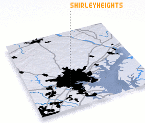 Places with similar names to Shirley Heights, United States - USA ::
// Sherril Heights (US)
Disclaimer :: Information on this page comes without warranty of any kind |
||
|
Where is Shirley Heights? Elevation and coordinates ::
Latitude (lat): 39°13'0"N Longitude (lon): 76°40'42"W
Elevation (approx.): 36m (map arrows pan, magnifying glasses zoom) |
||
|
Visiting Shirley Heights? Hotel/Accommodation ::
Book a hotel in Shirley Heights Travel Guide ::
rental cars ::
car rental offers GPS waypoint ::
download a GPX waypoint (PoI) of Shirley Heights for your GPS receiver
|
||