|
search place name
|
||
Smithville (Maryland, United States - USA)Smithville is a town in the Maryland region of United States - USA. An overview map of the region around Smithville is displayed below.
regional and 3d topo map of Smithville, United States - USA ::

Smithville airports ::
The nearest airport is APG - Aberdeen Phillips Aaf, located 19.4 km north of Smithville.
Other airports nearby include BWI - Baltimore Washington Intl (50.2 km west), DOV - Dover Afb (58.5 km east), ILG - Wilmington New Castle (60.5 km north east), ADW - Camp Springs Andrews Afb (Washington Dc Naf) (85.0 km south west), Nearby towns ::
Parson Hill (1.4km north east) //
Butlertown (1.7km south) //
Catts Corner (1.8km south east) //
Kentfield (1.9km north) //
Worton (2.9km south east) //
Hanesville (3.4km south west) //
Worton Heights (3.3km south west) //
The Pines (3.7km north east) //
Newtown (3.5km west) //
Kinnairds Point (4.2km north west) //
Lynch (3.9km east) //
Chesapeake Landing (4.9km south west) //
Millbrook (4.8km south west) //
Coleman (5.5km north east) //
Chesapeake Landing (5.2km south west) //
Melitota (5.4km south west) //
Buck Neck (5.4km south west) //
Buck Neck Landing (5.8km south west) //
Goose Hill (6.2km south east) //
Copeland (5.6km west) //
Echo Hill (7.3km north) //
Bigwoods (5.8km east) //
Great Oak Manor (6.2km south west) //
Hassengers Corner (6.3km south east) //
Still Pond (6.4km north east) //
Coventry Farms (7.8km south) //
Hepbron (6.2km east) //
Crestview (7.8km south east) //
Washington Park (8.3km south) //
[all distances 'as the bird flies' and approximate] 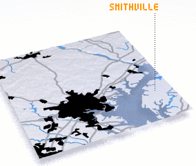 Places with similar names to Smithville, United States - USA ::
// Smithville (US)
// Smithville (US)
// Smithville (US)
// Smithville (US)
// Smithville (US)
// Smith Valley (US)
// Smithville (US)
// Smithville (US)
// Smithville (US)
// Smithville (US)
Disclaimer :: Information on this page comes without warranty of any kind |
||
|
Where is Smithville? Elevation and coordinates ::
Latitude (lat): 39°17'51"N Longitude (lon): 76°6'30"W
Elevation (approx.): 27m (map arrows pan, magnifying glasses zoom) |
||
|
Visiting Smithville? Hotel/Accommodation ::
Book a hotel in Smithville Travel Guide ::
rental cars ::
car rental offers GPS waypoint ::
download a GPX waypoint (PoI) of Smithville for your GPS receiver
|
||