|
search place name
|
||
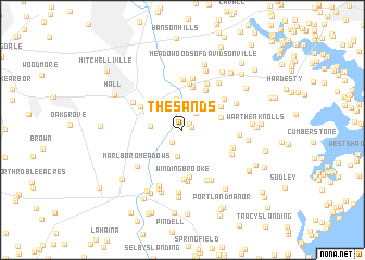
The Sands (Maryland, United States - USA)The Sands is a town in the Maryland region of United States - USA. An overview map of the region around The Sands is displayed below.
regional and 3d topo map of The Sands, United States - USA ::
The Sands airports ::
The nearest airport is ADW - Camp Springs Andrews Afb (Washington Dc Naf), located 18.1 km west of The Sands.
Other airports nearby include DCA - Ronald Reagan Washington Natl (31.7 km west), BWI - Baltimore Washington Intl (33.9 km north), IAD - Washington Dulles Intl (68.4 km west), NHK - Patuxent River Nas (68.7 km south), Nearby towns ::
Hawthorne Woods (0.7km east) //
Chinquapin Crest (0.8km north east) //
Maryland Manor Trailer Park (1.6km south west) //
Davidsonville Gardens (2.0km north east) //
Trails End Trailer Park (2.7km north) //
Baynard (2.7km south) //
Hardesty (3.2km north) //
Heritage Hills (2.6km west) //
Cheston (3.3km east) //
Queen Anne Estates (3.6km north west) //
Davidsonville Woods (4.5km north) //
Merrywood (4.0km north east) //
King Manor (4.5km north east) //
Patuxent Manor (4.8km north) //
Rustic Knolls (4.9km south) //
Queen Anne Knolls (4.1km north west) //
Winding Brooke (5.1km south) //
Riverwood (5.2km north) //
Merrywood Manor (4.6km north east) //
Pond View Acres (5.4km south) //
Velmeade (5.3km north) //
Friends Choice (5.2km north) //
Hunt Valley Estates (4.5km south east) //
Hunt Chapel (4.7km south east) //
Lothian Estates (5.5km south) //
Kidwells Corner (4.9km north west) //
Harwood (4.6km east) //
Lothian Woods (5.7km south east) //
Marlboro Meadows (5.2km south west) //
[all distances 'as the bird flies' and approximate] 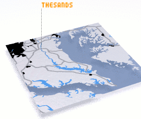 Places with similar names to The Sands, United States - USA ::
// The Sands (ZA)
Disclaimer :: Information on this page comes without warranty of any kind |
||
|
Where is The Sands? Elevation and coordinates ::
Latitude (lat): 38°52'12"N Longitude (lon): 76°40'24"W
Elevation (approx.): 16m (map arrows pan, magnifying glasses zoom) |
||
|
Visiting The Sands? Hotel/Accommodation ::
Book a hotel in The Sands Travel Guide ::
rental cars ::
car rental offers GPS waypoint ::
download a GPX waypoint (PoI) of The Sands for your GPS receiver
|
||