|
search place name
|
||
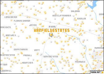
Warfield Estates (Maryland, United States - USA)Warfield Estates is a town in the Maryland region of United States - USA. An overview map of the region around Warfield Estates is displayed below.
regional and 3d topo map of Warfield Estates, United States - USA ::
Warfield Estates airports ::
The nearest airport is BWI - Baltimore Washington Intl, located 32.7 km east of Warfield Estates.
Other airports nearby include DCA - Ronald Reagan Washington Natl (47.4 km south), IAD - Washington Dulles Intl (52.7 km south west), ADW - Camp Springs Andrews Afb (Washington Dc Naf) (53.7 km south), APG - Aberdeen Phillips Aaf (76.5 km east), Nearby towns ::
Green Meadows (0.7km north east) //
Glenwood Estates (0.7km east) //
Glenwood (1.0km north west) //
Countryside (0.9km south west) //
Brantly (1.3km east) //
Woodside Estates (1.7km north) //
Knollwood (1.7km south) //
Dill (1.8km south east) //
Gwenlee Estates (1.9km east) //
Inwood (2.6km north) //
Gary (2.4km south east) //
Rover Mill Estates (2.3km north east) //
Burnt Woods (2.2km east) //
The Heritage (2.7km south east) //
Roxbury (2.9km south west) //
Millys Delight (3.0km north west) //
Glenelg (3.1km south east) //
Roxbury Mills (3.5km south west) //
Daisy Hill Estates (3.9km west) //
Ivory (3.8km east) //
The Corners (4.0km south east) //
Carrs Mill (4.7km north west) //
Oakwood Overlook (4.5km south east) //
Bushy Park Estates (4.8km north west) //
Daisy (4.2km north west) //
Justifiable (5.4km north) //
Dayton Meadows (5.1km south east) //
Villa Monticello (5.3km north) //
Jennings Chapel Woods (4.4km west) //
[all distances 'as the bird flies' and approximate] 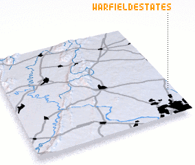 Places with similar names to Warfield Estates, United States - USA :: Disclaimer :: Information on this page comes without warranty of any kind |
||
|
Where is Warfield Estates? Elevation and coordinates ::
Latitude (lat): 39°16'44"N Longitude (lon): 77°1'24"W
Elevation (approx.): 168m (map arrows pan, magnifying glasses zoom) |
||
|
Visiting Warfield Estates? Hotel/Accommodation ::
Book a hotel in Warfield Estates Travel Guide ::
rental cars ::
car rental offers GPS waypoint ::
download a GPX waypoint (PoI) of Warfield Estates for your GPS receiver
|
||