|
search place name
|
||
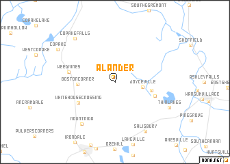
Alander (Massachusetts, United States - USA)Alander is a town in the Massachusetts region of United States - USA. An overview map of the region around Alander is displayed below.
regional and 3d topo map of Alander, United States - USA ::
Alander airports ::
The nearest airport is BDL - Windsor Locks Bradley Intl, located 66.2 km east of Alander.
Other airports nearby include HFD - Hartford Brainard (76.5 km south east), CEF - Chicopee Falls Westover Arb Metropolitan (78.6 km east), SWF - Newburgh Stewart Intl (81.1 km south west), ALB - Albany Intl (81.7 km north), Nearby towns ::
Joyceville (3.5km east) //
Boston Corner (4.6km west) //
Hammertown (4.7km east) //
Whitehouse Crossing (5.6km south west) //
Taconic (5.3km south east) //
Weed Mines (5.9km west) //
Mount Riga (7.9km south west) //
Salisbury (8.9km south east) //
Copake Falls (8.6km north west) //
Twin Lakes (7.8km south east) //
[all distances 'as the bird flies' and approximate] 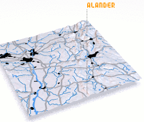 Places with similar names to Alander, United States - USA ::
// Aulander (US)
// Alondra (HN)
// Alineadero (VE)
// Al ‘Antarī (YE)
// Alandar (AF)
// Alandur (IN)
// Alāndurai (IN)
// Āl Nādir (SA)
Disclaimer :: Information on this page comes without warranty of any kind |
||
|
Where is Alander? Elevation and coordinates ::
Latitude (lat): 42°3'22"N Longitude (lon): 73°28'0"W
Elevation (approx.): 560m (map arrows pan, magnifying glasses zoom) |
||
|
Visiting Alander? Hotel/Accommodation ::
Book a hotel in Alander Travel Guide ::
rental cars ::
car rental offers GPS waypoint ::
download a GPX waypoint (PoI) of Alander for your GPS receiver
|
||