|
search place name
|
||
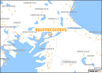
Bourne Corners (Massachusetts, United States - USA)Bourne Corners is a town in the Massachusetts region of United States - USA. An overview map of the region around Bourne Corners is displayed below.
regional and 3d topo map of Bourne Corners, United States - USA ::
Bourne Corners airports ::
The nearest airport is PVD - Providence Theodore Francis Green State, located 67.6 km west of Bourne Corners.
Other airports nearby include ACK - Nantucket Mem (71.8 km south east), BOS - Boston General Edward Lawrence Logan Intl (75.6 km north west), BED - Bedford Laurence G Hanscom Fld (97.7 km north west), CEF - Chicopee Falls Westover Arb Metropolitan (167.1 km west), Nearby towns ::
Buzzards Bay (1.1km south west) //
Bourne (1.3km south east) //
Jefferson Shores (1.8km west) //
Gray Gables (2.2km south west) //
Indian Heights (2.1km north west) //
Monument Beach (3.5km south) //
Point Independence (3.6km west) //
Riverside (3.9km west) //
Pondville (5.5km north) //
Onset (4.3km west) //
Bournedale (4.6km north east) //
Tahanto Beach (5.8km south) //
North Pocasset (6.2km south) //
White Island Shores (5.9km north) //
Pocasset Station (6.5km south) //
Barlows Landing (6.9km south) //
Pocasset (7.3km south) //
East Wareham (5.5km west) //
Onset Station (5.8km west) //
Patuisset (7.7km south) //
Camp Chacalot (7.6km north west) //
South Pocasset (8.5km south) //
Cedarville (7.9km north east) //
Sagamore (6.9km east) //
Camp Squanto (9.2km north) //
Sagamore Highlands (8.6km north east) //
Cedarville Landing (8.9km north east) //
Sagamore Beach (8.4km north east) //
Nameloc Heights (9.3km north east) //
[all distances 'as the bird flies' and approximate] 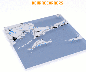 Places with similar names to Bourne Corners, United States - USA :: Disclaimer :: Information on this page comes without warranty of any kind |
||
|
Where is Bourne Corners? Elevation and coordinates ::
Latitude (lat): 41°45'4"N Longitude (lon): 70°36'30"W
Elevation (approx.): 10m (map arrows pan, magnifying glasses zoom) |
||
|
Visiting Bourne Corners? Hotel/Accommodation ::
Book a hotel in Bourne Corners Travel Guide ::
rental cars ::
car rental offers GPS waypoint ::
download a GPX waypoint (PoI) of Bourne Corners for your GPS receiver
|
||