|
search place name
|
||
Duxbury (Massachusetts, United States - USA)Duxbury is a town in the Massachusetts region of United States - USA. An overview map of the region around Duxbury is displayed below.
regional and 3d topo map of Duxbury, United States - USA ::

nearby GPS traces from timatio ::
Duxbury airports ::
The nearest airport is BOS - Boston General Edward Lawrence Logan Intl, located 45.1 km north west of Duxbury.
Other airports nearby include BED - Bedford Laurence G Hanscom Fld (69.6 km north west), PVD - Providence Theodore Francis Green State (70.9 km south west), ACK - Nantucket Mem (101.4 km south east), CEF - Chicopee Falls Westover Arb Metropolitan (154.9 km west), Nearby towns ::
Camp Chappa Challa (1.1km north east) //
Millbrook (1.4km north west) //
South Duxbury (2.2km south west) //
Cox Corner (2.5km north west) //
Baileys Corner (2.8km south west) //
Green Harbor (4.4km north east) //
Miles Standish Park (4.2km south west) //
Tinkertown (4.4km south west) //
Kingston Shores (5.5km south west) //
Brant Rock (5.6km north east) //
Rocky Nook Point (5.6km south west) //
Rocky Nook Park (5.8km south west) //
North Duxbury (5.2km north west) //
Ocean Bluff (6.4km north) //
Miramar (5.6km south west) //
Island Creek (5.4km south west) //
Marshfield (6.2km north west) //
Rocky Nook (6.5km south) //
Tree of Knowledge Corner (5.2km west) //
Fort Standish (6.1km south east) //
Cordage (7.1km south) //
Fieldston (7.3km north) //
Tarkiln (5.5km west) //
Kent Park (7.6km north) //
Kingston (6.8km south west) //
Northwest Duxbury (6.0km west) //
North Plymouth (7.9km south) //
Rexhame (8.0km north) //
Ashdod (7.1km north west) //
[all distances 'as the bird flies' and approximate] 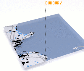 Places with similar names to Duxbury, United States - USA ::
Disclaimer :: Information on this page comes without warranty of any kind |
||
|
Where is Duxbury? Elevation and coordinates ::
Latitude (lat): 42°2'30"N Longitude (lon): 70°40'22"W
Elevation (approx.): 11m (map arrows pan, magnifying glasses zoom) |
||
|
Visiting Duxbury? Hotel/Accommodation ::
Book a hotel in Duxbury Travel Guide ::
rental cars ::
car rental offers GPS waypoint ::
download a GPX waypoint (PoI) of Duxbury for your GPS receiver
|
||