|
search place name
|
||
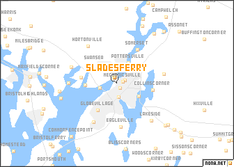
Slades Ferry (Massachusetts, United States - USA)Slades Ferry is a town in the Massachusetts region of United States - USA. An overview map of the region around Slades Ferry is displayed below.
regional and 3d topo map of Slades Ferry, United States - USA ::
Slades Ferry airports ::
The nearest airport is PVD - Providence Theodore Francis Green State, located 21.8 km west of Slades Ferry.
Other airports nearby include BOS - Boston General Edward Lawrence Logan Intl (72.6 km north), BED - Bedford Laurence G Hanscom Fld (83.9 km north), ACK - Nantucket Mem (105.4 km south east), HFD - Hartford Brainard (124.1 km west), Nearby towns ::
Fall River Station (0.8km south east) //
Mechanicsville (0.8km north east) //
Bowenville (1.1km north east) //
Fall River (2.2km south) //
Brayton Point (2.2km west) //
Pottersville (3.5km north east) //
Steep Brook (3.4km north east) //
Oak Grove Village (3.3km south east) //
Swansea Center (3.7km north west) //
Swansea (4.0km north west) //
South Swansea (3.8km west) //
Globe Village (4.9km south west) //
Ocean Grove (4.4km west) //
Collins Corner (4.4km east) //
Somerset (5.9km north east) //
Eagleville (7.0km south) //
North Tiverton (6.8km south west) //
Hortonville (6.9km north west) //
Touisset (5.8km west) //
Fighting Rock Corner (5.9km east) //
Luther Corner (6.0km north west) //
Lakeside (7.3km south east) //
Camp Merriwood (9.2km north east) //
North Westport (8.9km south east) //
Beulah Corners (9.0km south east) //
Common Fence Point (10.1km south west) //
Assonet Bay Shores (10.1km north east) //
[all distances 'as the bird flies' and approximate]  Places with similar names to Slades Ferry, United States - USA :: Disclaimer :: Information on this page comes without warranty of any kind |
||
|
Where is Slades Ferry? Elevation and coordinates ::
Latitude (lat): 41°43'15"N Longitude (lon): 71°9'30"W
Elevation (approx.): 2m (map arrows pan, magnifying glasses zoom) |
||
|
Visiting Slades Ferry? Hotel/Accommodation ::
Book a hotel in Slades Ferry Travel Guide ::
rental cars ::
car rental offers GPS waypoint ::
download a GPX waypoint (PoI) of Slades Ferry for your GPS receiver
|
||