|
search place name
|
||
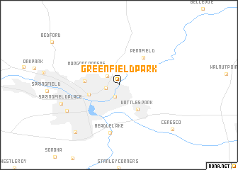
Greenfield Park (Michigan, United States - USA)Greenfield Park is a town in the Michigan region of United States - USA. An overview map of the region around Greenfield Park is displayed below.
regional and 3d topo map of Greenfield Park, United States - USA ::
Greenfield Park airports ::
The nearest airport is LAN - Lansing Capital City, located 66.8 km north east of Greenfield Park.
Other airports nearby include GRR - Grand Rapids Gerald R Ford Intl (68.4 km north west), YIP - Detroit Willow Run (133.0 km east), DTW - Detroit Metro Wayne Co (147.8 km east), GUS - Peru Grissom Arb (205.6 km south west), Nearby towns ::
Brownlee Park (1.8km south) //
Verona Park (1.6km west) //
Maplehurst (2.0km north west) //
Wattles Park (4.4km south east) //
Battle Creek (3.8km south west) //
Orchard Park (4.0km west) //
Morgan Corners (4.3km north west) //
Pennfield (5.1km north east) //
Beadle Lake (7.6km south) //
Lakeview (7.3km south west) //
Old Mill Gardens (9.0km south west) //
Ceresco (9.4km south east) //
[all distances 'as the bird flies' and approximate] 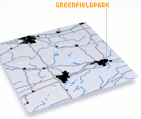 Places with similar names to Greenfield Park, United States - USA ::
Disclaimer :: Information on this page comes without warranty of any kind |
||
|
Where is Greenfield Park? Elevation and coordinates ::
Latitude (lat): 42°20'6"N Longitude (lon): 85°8'14"W
Elevation (approx.): 271m (map arrows pan, magnifying glasses zoom) |
||
|
Visiting Greenfield Park? Hotel/Accommodation ::
Book a hotel in Greenfield Park Travel Guide ::
rental cars ::
car rental offers GPS waypoint ::
download a GPX waypoint (PoI) of Greenfield Park for your GPS receiver
|
||