|
search place name
|
||
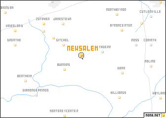
New Salem (Michigan, United States - USA)New Salem is a town in the Michigan region of United States - USA. An overview map of the region around New Salem is displayed below.
regional and 3d topo map of New Salem, United States - USA ::
New Salem airports ::
The nearest airport is GRR - Grand Rapids Gerald R Ford Intl, located 26.8 km north east of New Salem.
Other airports nearby include LAN - Lansing Capital City (99.5 km east), MDW - Chicago Midway Intl (193.5 km south west), Nearby towns ::
North Dorr (3.7km north east) //
Burnips (3.9km south west) //
Gitchel (4.5km north west) //
Forest Grove (6.8km north west) //
Jamestown (8.6km north west) //
Dorr (7.2km south east) //
Forest Grove Station (9.1km north west) //
Byron Center (9.2km north east) //
Zutphen (10.3km north west) //
Hilliards (10.7km south east) //
[all distances 'as the bird flies' and approximate] 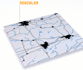 Places with similar names to New Salem, United States - USA ::
Disclaimer :: Information on this page comes without warranty of any kind |
||
|
Where is New Salem? Elevation and coordinates ::
Latitude (lat): 42°45'14"N Longitude (lon): 85°48'7"W
Elevation (approx.): 212m (map arrows pan, magnifying glasses zoom) |
||
|
Visiting New Salem? Hotel/Accommodation ::
Book a hotel in New Salem Travel Guide ::
rental cars ::
car rental offers GPS waypoint ::
download a GPX waypoint (PoI) of New Salem for your GPS receiver
|
||