|
search place name
|
||
Carmichael (Mississippi, United States - USA)Carmichael is a town in the Mississippi region of United States - USA. An overview map of the region around Carmichael is displayed below.
regional and 3d topo map of Carmichael, United States - USA ::

Carmichael airports ::
The nearest airport is JAN - Jackson Evers Intl, located 50.6 km north east of Carmichael.
Other airports nearby include MLU - Monroe Rgnl (150.1 km west), GWO - Greenwood Leflore (163.4 km north), BTR - Baton Rouge Metro Ryan Fld (180.2 km south), ESF - Alexandria Esler Rgnl (183.2 km south west), Nearby towns ::
Bear Creek (1.3km south east) //
Chapel Hill (5.2km north) //
Jack (6.9km south west) //
Thompsonville (6.9km east) //
[all distances 'as the bird flies' and approximate] 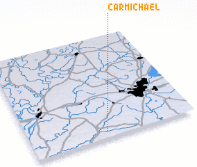 Places with similar names to Carmichael, United States - USA ::
// Carmichael (US)
// Caramouchel (PT)
// Carmichael (US)
// Carmichael (US)
// Grymes Hill (US)
// Grammichele (IT)
// Ker-Michel (FR)
// Carmichael (TT)
Disclaimer :: Information on this page comes without warranty of any kind |
||
|
Where is Carmichael? Elevation and coordinates ::
Latitude (lat): 32°4'11"N Longitude (lon): 90°31'53"W
Elevation (approx.): 92m (map arrows pan, magnifying glasses zoom) |
||
|
Visiting Carmichael? Hotel/Accommodation ::
Book a hotel in Carmichael Travel Guide ::
rental cars ::
car rental offers GPS waypoint ::
download a GPX waypoint (PoI) of Carmichael for your GPS receiver
|
||