|
search place name
|
||
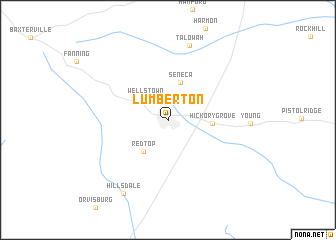
Lumberton (Mississippi, United States - USA)Lumberton is a town in the Mississippi region of United States - USA. An overview map of the region around Lumberton is displayed below.
regional and 3d topo map of Lumberton, United States - USA ::
Lumberton airports ::
The nearest airport is BIX - Biloxi Keesler Afb, located 82.7 km south east of Lumberton.
Other airports nearby include MOB - Mobile Rgnl (120.7 km east), MSY - Louis Armstrong New Orleans Intl (135.9 km south west), BFM - Mobile Downtown (138.8 km east), NBG - New Orleans Nas Jrb (141.9 km south west), Nearby towns ::
Wells Town (3.2km north west) //
Seneca (4.4km north) //
Red Top (4.3km south west) //
Hickory Grove (4.3km east) //
Talowah (8.6km north) //
Hillsdale (9.2km south west) //
[all distances 'as the bird flies' and approximate]  Places with similar names to Lumberton, United States - USA ::
// Lamartine (US)
// Lamberton (US)
// Lamartine (US)
// Lumberton (US)
// Lamerden (DE)
// La Martina (PA)
// La Martina (IT)
// L-Imbordin (MT)
// Lumberton (US)
// Lumberton (US)
Disclaimer :: Information on this page comes without warranty of any kind |
||
|
Where is Lumberton? Elevation and coordinates ::
Latitude (lat): 31°0'4"N Longitude (lon): 89°27'8"W
Elevation (approx.): 92m (map arrows pan, magnifying glasses zoom) |
||
|
Visiting Lumberton? Hotel/Accommodation ::
Book a hotel in Lumberton Travel Guide ::
rental cars ::
car rental offers GPS waypoint ::
download a GPX waypoint (PoI) of Lumberton for your GPS receiver
|
||